Doomcock
- Entertainment , News , Politics
- August 16, 2024
- 19 views
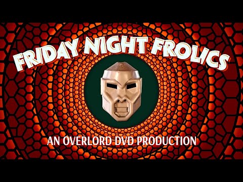
Friday Night Frolics | Harvey Tries to Stay on the Wagon | The Necronomicorn | Larry Dracula | FUN!
Friday Night Frolics is back, despite Doomcock being smacked hard with nasty allergies, and yes folks, Harvey Cthuhlu is going to try hard to avoid becoming Harvey Kushthulu tonight! Will he succeed? Who knows…but it's almost certain he will be bringing the pain tonight with…THE NECRONOMICORN! (Dun-dun-DAAAAAA!) Join me, Harvey, Sabu, and the Usual Suspects for a night of fun and frolics!
- Entertainment , News , Politics
- August 16, 2024
- 24 views
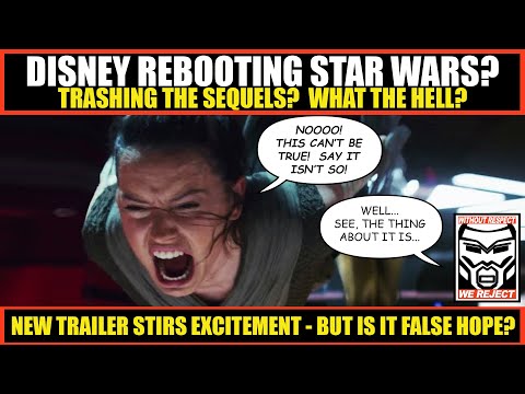
Disney REBOOTING Star Wars?! Removing Sequels from CANON?
A trailer for a Star Wars series was unveiled at D23 that has a portion of former Star Wars fans uncharacteristically excited, believing this series is the first step towards rebooting Star Wars and removing the sequels from canon. I am skeptical about what this means, but it is an unexpected and intriguing development that could lead to big changes in Star Wars, or simply fizzle out as a blip on the radar. In this video, requested by a number of my viewers, I cast a fair but skeptical eye on what's coming, going over the pros and cons as I see them, but make no mistake – this is an interesting development in the train wreck that is Disney Star Wars. #disney #starwars #disneyplus
PLEASE SUBSCRIBE AND SUPPORT US BY BECOMING A CHANNEL MEMBER! Go to youtube.com/overlorddvd and click the JOIN button right next to the SUBSCRIBE button, where you can get custom emojis, exclusive member's only videos, and exclusive Arch Villain livestreams speaking directly to Doomcock!
https://www.youtube.com/overlorddvd
PLEASE consider supporting me on Patreon or Subscribestar! You get access to years of exclusive content, and folks who sign up at the Legionnaire level get a signed photo of Doomcock with a personal message, a Membership Card on metallic cardstock, and a certificate of supervillainy! Harvey's podcasts there are my personal favorites, along with full-length movie DVD Commentaries of films like Blade Runner and Star Trek II: Wrath of Khan! Plus I post links there to all my videos and livestreams, since YouTube isn't good at getting the word out! HELP US SAVE POP CULTURE BY JOINING TODAY!
patreon.com/doomcock
subscribestar.com/doomcock
https://www.youtube.com/@PopCultureKO
- Entertainment , News , Politics
- August 14, 2024
- 17 views
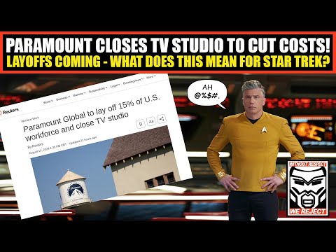
Paramount CLOSES TV Studio as Layoffs Loom | What Does This Mean for Star Trek? | Rumor CONFIRMED?
Yesterday the news broke that Paramount is closing their TV Studio and laying off a large number of employees…how will this impact Star Trek? And is this confirmation of the rumored emergency Star Trek meeting? #startrek #paramountplus #fail
PLEASE SUPPORT US BY BECOMING A CHANNEL MEMBER! Go to youtube.com/overlorddvd and click the JOIN button right next to the SUBSCRIBE button, where you can get custom emojis, exclusive member's only videos, and exclusive Arch Villain livestreams speaking directly to Doomcock!
https://www.youtube.com/overlorddvd
PLEASE consider supporting me on Patreon or Subscribestar! You get access to years of exclusive content, and folks who sign up at the Legionnaire level get a signed photo of Doomcock with a personal message, a Membership Card on metallic cardstock, and a certificate of supervillainy! Harvey's podcasts there are my personal favorites, along with full-length movie DVD Commentaries of films like Blade Runner and Star Trek II: Wrath of Khan! Plus I post links there to all my videos and livestreams, since YouTube isn't good at getting the word out! HELP US SAVE POP CULTURE BY JOINING TODAY!
patreon.com/doomcock
subscribestar.com/doomcock
https://www.youtube.com/@PopCultureKO
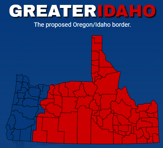
The “Greater Idaho Project” What is it?
By Arthur Potatoehammer The “Greater Idaho Project” is a political movement that advocates for the secession of several rural counties in Eastern Oregon to join the state of Idaho. This…
- Entertainment , News , Politics
- August 13, 2024
- 18 views
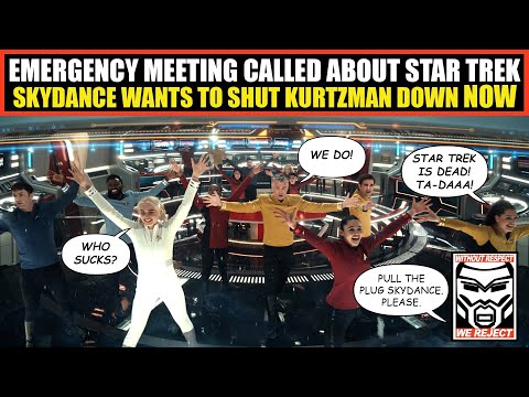
Emergency Meeting Called at Paramount About Star Trek | Skydance Wants to STOP Kurtzman NOW!
A source tells me an emergency meeting is being called by Skydance regarding Star Trek. Apparently Skydance wants to know why the hell Paramount is greenlighting more fake Star Trek garbage that nobody wants from Secret Hideout, especially given all the money Skydance is putting out to save Paramount from themselves! Here's why it's an emergency meeting, and what they reportedly want the outcome to be! #startrek #paramountplus #fail
PLEASE SUPPORT US BY BECOMING A CHANNEL MEMBER! Go to youtube.com/overlorddvd and click the JOIN button right next to the SUBSCRIBE button, where you can get custom emojis, exclusive member's only videos, and exclusive Arch Villain livestreams speaking directly to Doomcock!
https://www.youtube.com/overlorddvd
PLEASE consider supporting me on Patreon or Subscribestar! You get access to years of exclusive content, and folks who sign up at the Legionnaire level get a signed photo of Doomcock with a personal message, a Membership Card on metallic cardstock, and a certificate of supervillainy! Harvey's podcasts there are my personal favorites, along with full-length movie DVD Commentaries of films like Blade Runner and Star Trek II: Wrath of Khan! Plus I post links there to all my videos and livestreams, since YouTube isn't good at getting the word out! HELP US SAVE POP CULTURE BY JOINING TODAY!
patreon.com/doomcock
subscribestar.com/doomcock
https://www.youtube.com/@PopCultureKO
IAEA Confirms "No Impact On Nuclear Safety" After Zaporizhzhia Power Plant Fire
IAEA Confirms “No Impact On Nuclear Safety” After Zaporizhzhia Power Plant Fire Update (Monday): The geopolitical environment in Eastern Europe and the Middle East is quickly heating up, with Ukraine at the…
Futures Gain As Yen Resumes Slides, Oil Jumps
Futures Gain As Yen Resumes Slides, Oil Jumps US equity futures are seeing a slight bid, tracking Asian and European markets higher, as the week starts off more muted than…
Travel Trends Deteriorating As Consumer Downturn Worsens
“Travel Trends Deteriorating” As Consumer Downturn Worsens Consumers are quickly changing their spending habits as the pullback across the leisure and travel industry becomes more pronounced. We first asked this question…
Theater Of The Absurd, Harris-Walz Edition
Theater Of The Absurd, Harris-Walz Edition Authored by Roger Kimball via American Greatness, H.L. Mencken apparently never quite said that “No one ever went broke underestimating the intelligence of the…
The Worst Is Behind Us, The US Trucking Industry Is Showing Signs Of A Resurrection
“The Worst Is Behind Us”: The US Trucking Industry Is Showing Signs Of A Resurrection It has been a long ugly road for the trucking industry in the U.S. since…