


Do Americans Prefer Equalizing Outcome Or Opportunity In 2024?
Authored by Gonzalo Schwarz via RealClearPolitics.com,
The American Dream was built on a promise of equality – a promise of equality in terms of life, liberty, and the pursuit of happiness.
During the 2024 election, Donald Trump and Kamala Harris are both working overtime to say why Republicans or Democrats are better on the equality issue.
But what kind of equality?
Harris is known for promoting “equity,” while Trump is quick to invoke the American Dream but slower to define it.
And so, voters are left wondering.
Many of the policies uttered on the campaign trail are focused on equalizing outcomes – or, at the very least, equalizing starting points.
To use a Harris quote, “Equitable treatment means we all end up at the same place.”
She also proposes an opportunity agenda, promising to crack down on price gouging, raise the minimum wage, provide $25,000 in down payment assistance for first-time homebuyers, and increase the child tax credit, among other proposals. Pushback has been swift among economists and policy researchers, who cite the unintended consequences of price controls and other forms of government overreach.
Meanwhile, Trump insists on continuing his tariff policy and expanding the child tax credit. Cue similar pushback: In his case, the vast majority of economists and other experts agree about the negative impact of tariffs on economic growth.
In the end, what do American voters actually want?
The candidate who is most likely to win come November is the candidate who is more adept at selling equality as most Americans actually see it.
In a recent survey on the American Dream conducted with NORC at the University of Chicago, we put the question to the test. We asked people if they think equality means equality before the law and having a fair chance to pursue opportunities regardless of where they started (equality to opportunity), if equality means that everyone starts in the same with people given tools to help them catch up with others (equalizing starting points), or if equality just means people ending up in the same place like candidate Harris has said.
Not surprisingly, Americans don’t believe that equality means everyone ending in the same place.
Only 4% of U.S. adults say so, while equalizing people’s starting points only garnered 18% of the respondent vote.
On the other hand, nearly two-thirds of Americans claim equality is actually about the equality of opportunity.
This holds true across age, income level, education, and even political leanings.
Democrats and Republicans generally agree that proper policymaking is predicated upon support for equality of opportunity.
Loading…
Originally Posted at; https://www.zerohedge.com//
Stay Updated with news.freeptomaineradio.com’s Daily Newsletter
Stay informed! Subscribe to our daily newsletter to receive updates on our latest blog posts directly in your inbox. Don’t let important information get buried by big tech.
Current subscribers:
Potential Tropical Cyclone Six Forecast Discussion
063
WTNT41 KNHC 090232
TCDAT1

Potential Tropical Cyclone Six Discussion Number   2
NWS National Hurricane Center Miami FL       AL062024
1000 PM CDT Sun Sep 08 2024

The system is gradually becoming better organized with deep
convection increasing in coverage and intensity over the
southwestern Gulf of Mexico.  However, earlier visible satellite
imagery and aircraft data from the Air Force Hurricane Hunters
indicate that the disturbance does not have a well-defined center
and still resembles an elongated trough.  The initial intensity
remains 45 kt based on the aircraft data.  The strongest winds are
occurring on the system's west side, and are likely enhanced by the
barrier jet associated with the Sierra Madre Mountains in Mexico.

The initial motion is estimated to be 320/4 kt.  A mid-level ridge
situated over the southeastern Gulf of Mexico and western Atlantic
should steer the disturbance slowly northward or north-northwestward
through Tuesday morning, likely keeping the core of the system off
the coast of Mexico and southern Texas through that time.  By late
Tuesday, a turn to the northeast with an increase in forward speed
is forecast as the system moves in the flow between the ridge and an
approaching shortwave trough.  That motion should take the cyclone
to the Louisiana or Upper Texas coast on Wednesday.  A
north-northeastward motion is forecast after landfall when the
system merges with the trough. The NHC track forecast has been
nudged eastward toward the latest runs of the GFS and ECMWF models.
It should be noted that confidence in the track forecast is lower
than normal since the system does not have a well-defined center.

Little change in strength is expected during the next 12 to 24 hours
as it will likely take some time for the system to consolidate and
develop a well organized circulation.  Once the system is able to
close off and contract, steady strengthening is forecast as the
cyclone will be over warm waters and within a region of high
moisture and upper-level diffluence.  However, some of the models
show an increase in shear and slightly drier air affecting the
system around the time it reaches the coast.  The NHC intensity
forecast is raised from the previous one and lies roughly near the
middle of the guidance envelope.

The highest winds are expected to remain on the west side of the
system during the next day or so, but these winds should shift to
the eastern side of the circulation before the cyclone reaches the
Gulf Coast.


KEY MESSAGES:

1. The system is forecast to become a tropical storm on Monday as it
moves near the western Gulf of Mexico coast. Tropical Storm Watches
are in effect for northeastern Mexico and extreme southern Texas.

2. The system is forecast to become a hurricane before it reaches
the northwestern Gulf Coast by the middle of the week.  While it is
too soon to pinpoint the exact location and magnitude of impacts,
the potential for life-threatening storm surge and damaging winds
are increasing for portions of the Louisiana and Upper Texas
coastlines beginning Tuesday night.  Hurricane and Storm Surge
Watches will likely be issued for a portion of that area on Monday,
and residents should ensure they have their hurricane plan in
place.

3. Potential Tropical Cyclone Six is expected to bring heavy
rainfall and the risk of flash flooding from the coast of far
northeast Mexico into portions of coastal Texas and Louisiana
through Thursday.


FORECAST POSITIONS AND MAX WINDS

INIT  09/0300Z 21.9N  94.7W   45 KT  50 MPH...POTENTIAL TROP CYCLONE
 12H  09/1200Z 22.5N  95.1W   45 KT  50 MPH
 24H  10/0000Z 23.7N  95.7W   50 KT  60 MPH...TROPICAL CYCLONE
 36H  10/1200Z 25.0N  96.0W   55 KT  65 MPH
 48H  11/0000Z 26.2N  95.7W   60 KT  70 MPH
 60H  11/1200Z 28.0N  94.6W   70 KT  80 MPH
 72H  12/0000Z 29.9N  93.1W   70 KT  80 MPH...INLAND
 96H  13/0000Z 34.5N  90.7W   30 KT  35 MPH...POST-TROP/EXTRATROP
120H  14/0000Z 37.3N  89.5W   20 KT  25 MPH...POST-TROP/EXTRATROP

$$
Forecaster Cangialosi
Originally Posted at:
NATIONAL HURRICANE CENTER and CENTRAL PACIFIC HURRICANE CENTER
At The NATIONAL OCEANIC AND ATMOSPHERIC ADMINISTRATION
Stay Updated with news.freeptomaineradio.com’s Daily Newsletter
Stay informed! Subscribe to our daily newsletter to receive updates on our latest blog posts directly in your inbox. Don’t let important information get buried by big tech.
Current subscribers:
Potential Tropical Cyclone Six Forecast Advisory
000
WTNT21 KNHC 090231
TCMAT1

POTENTIAL TROPICAL CYCLONE SIX FORECAST/ADVISORY NUMBER   2
NWS NATIONAL HURRICANE CENTER MIAMI FL       AL062024
0300 UTC MON SEP 09 2024

POTENTIAL TROP CYCLONE CENTER LOCATED NEAR 21.9N  94.7W AT 09/0300Z
POSITION ACCURATE WITHIN  50 NM

PRESENT MOVEMENT TOWARD THE NORTH-NORTHWEST OR 340 DEGREES AT   4 KT

ESTIMATED MINIMUM CENTRAL PRESSURE 1003 MB
MAX SUSTAINED WINDS  45 KT WITH GUSTS TO  55 KT.
34 KT.......  0NE   0SE 140SW 160NW.
12 FT SEAS..  0NE 210SE 210SW 210NW.
WINDS AND SEAS VARY GREATLY IN EACH QUADRANT.  RADII IN NAUTICAL
MILES ARE THE LARGEST RADII EXPECTED ANYWHERE IN THAT QUADRANT.

REPEAT...CENTER LOCATED NEAR 21.9N  94.7W AT 09/0300Z
AT 09/0000Z CENTER WAS LOCATED NEAR 21.9N  94.7W

FORECAST VALID 09/1200Z 22.5N  95.1W
MAX WIND  45 KT...GUSTS  55 KT.
34 KT...  0NE   0SE 110SW 140NW.

FORECAST VALID 10/0000Z 23.7N  95.7W...TROPICAL CYCLONE
MAX WIND  50 KT...GUSTS  60 KT.
50 KT...  0NE  40SE  40SW   0NW.
34 KT... 50NE  70SE  80SW 120NW.

FORECAST VALID 10/1200Z 25.0N  96.0W
MAX WIND  55 KT...GUSTS  65 KT.
50 KT... 20NE  30SE  30SW   0NW.
34 KT... 80NE  70SE  70SW  80NW.

FORECAST VALID 11/0000Z 26.2N  95.7W
MAX WIND  60 KT...GUSTS  75 KT.
50 KT... 30NE  30SE   0SW  20NW.
34 KT... 90NE  70SE  50SW  60NW.

FORECAST VALID 11/1200Z 28.0N  94.6W
MAX WIND  70 KT...GUSTS  85 KT.
50 KT... 40NE  40SE  30SW  30NW.
34 KT... 90NE  80SE  50SW  60NW.

FORECAST VALID 12/0000Z 29.9N  93.1W...INLAND
MAX WIND  70 KT...GUSTS  85 KT.
50 KT... 30NE  40SE  30SW  20NW.
34 KT... 60NE  90SE  50SW  50NW.

EXTENDED OUTLOOK. NOTE...ERRORS FOR TRACK HAVE AVERAGED NEAR 125 NM
ON DAY 4 AND 175 NM ON DAY 5...AND FOR INTENSITY NEAR 15 KT EACH DAY

OUTLOOK VALID 13/0000Z 34.5N  90.7W...POST-TROP/EXTRATROP
MAX WIND  30 KT...GUSTS  40 KT.

OUTLOOK VALID 14/0000Z 37.3N  89.5W...POST-TROP/EXTRATROP
MAX WIND  20 KT...GUSTS  30 KT.

REQUEST FOR 3 HOURLY SHIP REPORTS WITHIN 300 MILES OF 21.9N  94.7W

INTERMEDIATE PUBLIC ADVISORY...WTNT31 KNHC/MIATCPAT1...AT 09/0600Z

NEXT ADVISORY AT 09/0900Z

$$
FORECASTER CANGIALOSI
Originally Posted at:
NATIONAL HURRICANE CENTER and CENTRAL PACIFIC HURRICANE CENTER
At The NATIONAL OCEANIC AND ATMOSPHERIC ADMINISTRATION
Stay Updated with news.freeptomaineradio.com’s Daily Newsletter
Stay informed! Subscribe to our daily newsletter to receive updates on our latest blog posts directly in your inbox. Don’t let important information get buried by big tech.
Current subscribers:
Potential Tropical Cyclone Six Public Advisory
000
WTNT31 KNHC 090231
TCPAT1

BULLETIN
Potential Tropical Cyclone Six Advisory Number   2
NWS National Hurricane Center Miami FL       AL062024
1000 PM CDT Sun Sep 08 2024

...TROPICAL STORM WATCH ISSUED FOR EXTREME SOUTHERN TEXAS...
...INCREASING RISK OF LIFE-THREATENING STORM SURGE AND
HURRICANE-FORCE WINDS ALONG THE LOUISIANA AND UPPER TEXAS COASTS BY
MID-WEEK...


SUMMARY OF 1000 PM CDT...0300 UTC...INFORMATION
-----------------------------------------------
LOCATION...21.9N 94.7W
ABOUT 320 MI...510 KM SSE OF MOUTH OF THE RIO GRANDE
ABOUT 550 MI...890 KM S OF CAMERON LOUISIANA
MAXIMUM SUSTAINED WINDS...50 MPH...85 KM/H
PRESENT MOVEMENT...NNW OR 340 DEGREES AT 5 MPH...7 KM/H
MINIMUM CENTRAL PRESSURE...1003 MB...29.62 INCHES


WATCHES AND WARNINGS
--------------------
CHANGES WITH THIS ADVISORY:

A Tropical Storm Watch has been issued for extreme southern Texas
from Port Mansfield southward to the Mouth of the Rio Grande.

SUMMARY OF WATCHES AND WARNINGS IN EFFECT:

A Tropical Storm Watch is in effect for...
* Barra del Tordo to the Mouth of the Rio Grande
* Mouth of the Rio Grande to Port Mansfield

A Tropical Storm Watch means that tropical storm conditions are
possible within the watch area, generally within 48 hours.

Hurricane, Storm Surge, and Tropical Storm Watches will likely be
required for portions of the Louisiana and Upper Texas coast on
Monday.

For storm information specific to your area in the United
States, including possible inland watches and warnings, please
monitor products issued by your local National Weather Service
forecast office. For storm information specific to your area
outside of the United States, please monitor products issued by
your national meteorological service.


DISCUSSION AND OUTLOOK
----------------------
At 1000 PM CDT (0300 UTC), the disturbance was centered near
latitude 21.9 North, longitude 94.7 West. The system is moving
toward the north-northwest near 5 mph (7 km/h). A slow northwestward
to northward motion is expected over the next day or so, followed
by a faster motion to the northeast beginning late Tuesday. On the
forecast track, the disturbance is expected to move just offshore of
the northern Gulf Coast of Mexico through Tuesday, and approach the
Louisiana and Upper Texas coastline on Wednesday.

Maximum sustained winds are near 50 mph (85 km/h) with higher gusts.
The system is expected to become a tropical storm on Monday,
with more significant intensification forecast to occur on Tuesday.
The system is forecast to become a hurricane before it reaches the
northwestern U.S. Gulf Coast.
* Formation chance through 48 hours...high...90 percent.
* Formation chance through 7 days...high...90 percent.

Tropical-storm-force winds extend outward up to 185 miles (295 km)
west of the center.

The estimated minimum central pressure is 1003 mb (29.62 inches).


HAZARDS AFFECTING LAND
----------------------
WIND:  Tropical storm conditions are possible within the watch
area along the northern coast of Mexico and extreme southern Texas
beginning Tuesday.

RAINFALL: Potential Tropical Cyclone Six is expected to bring storm
total rainfall of 4 to 8 inches, with local amounts to 12 inches,
from the coast of far northeast Mexico northward along portions of
the Texas coast and into Louisiana through Thursday. This rainfall
would lead to the risk of flash and urban flooding.

For a complete depiction of forecast rainfall associated with
Potential Tropical Cyclone Six, please see the National Weather
Service Storm Total Rainfall Graphic, available at
hurricanes.gov/graphics_at1.shtml?rainqpf and the Flash Flood Risk
graphic at hurricanes.gov/graphics_at1.shtml?ero.

STORM SURGE: Minor coastal flooding is possible along the Mexico
coast within areas of onshore flow.

SURF:  Swells generated by this system are affecting portions of the
Gulf coast of Mexico and are expected to spread northwestward across
the northwestern Gulf of Mexico coastline through midweek.  These
swells are likely to cause life-threatening surf and rip current
conditions.  Please consult products from your local weather office.


NEXT ADVISORY
-------------
Next intermediate advisory at 100 AM CDT.
Next complete advisory at 400 AM CDT.

$$
Forecaster Cangialosi
Originally Posted at:
NATIONAL HURRICANE CENTER and CENTRAL PACIFIC HURRICANE CENTER
At The NATIONAL OCEANIC AND ATMOSPHERIC ADMINISTRATION
Stay Updated with news.freeptomaineradio.com’s Daily Newsletter
Stay informed! Subscribe to our daily newsletter to receive updates on our latest blog posts directly in your inbox. Don’t let important information get buried by big tech.
Current subscribers:
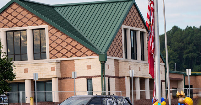
Report: Mother of Alleged School Shooter Warned School Prior to Attack
A report from the Washington Post, confirmed by the Associated Press, claims the alleged Apalachee High School attacker’s mother warned the school of an “extreme emergency” half an hour before shots rang out.
The Associated Press (AP) reported that the 14-year-old attacker’s aunt, Annie Brown, said the boy’s mom “spoke with a school counselor and urged them to ‘immediately’ find her son to check on him.”
The Tennessee Star noted that the Post zeroed in on text messages that “show that the school and family were in contact about [the mental health of the 14-year-old].”
A week before the shooting, Brown had allegedly informed a relative that the alleged attacker was having “homicidal and suicidal thoughts.”
On September 5, 2024, the day after the Apalachee High School attack, the 14-year-old’s father, Colin Gray, was arrested and charged with involuntary manslaughter and second-degree murder, among other things.
The Georgia Bureau of Investigation (GBI) explained that the charges “stem from Mr. Gray knowingly allowing his son … to possess a weapon.”
GBI called for communities across the state to encourage students “across this state to contact a member of their school faculty with any and all concerns of suspicious behavior that they may see.”
AWR Hawkins is an award-winning Second Amendment columnist for Breitbart News and the writer/curator of Down Range with AWR Hawkins, a weekly newsletter focused on all things Second Amendment, also for Breitbart News. He is the political analyst for Armed American Radio, a member of Gun Owners of America, a Pulsar Night Vision pro-staffer, and the director of global marketing for Lone Star Hunts. He was a Visiting Fellow at the Russell Kirk Center for Cultural Renewal in 2010 and has a Ph.D. in Military History. Follow him on Instagram: @awr_hawkins. You can sign up to get Down Range at breitbart.com/downrange. Reach him directly: awrhawkins@breitbart.com.
Originally Posted At www.breitbart.com
Stay Updated with news.freeptomaineradio.com’s Daily Newsletter
Stay informed! Subscribe to our daily newsletter to receive updates on our latest blog posts directly in your inbox. Don’t let important information get buried by big tech.
Current subscribers:

Former California State Sen. Gloria Romero Leaves the Democrat Party
Former California State Sen. Gloria Romero announced that she is ditching the Democrat Party, noting that it is “not the Democratic Party” she had “once championed.”
Romero, who previously served as the Senate Majority Leader in California, announced on Wednesday that she was “joining the growing number” of people who were leaving the Democrat Party and that she had changed her voter registration to the Republican Party.
“I am now another near-life-long Democrat who is joining the growing number of people, including key groups like Latinos, who are leaving the Democratic Party,” Romero said. “This is not the Democratic Party that I once championed. I do not recognize it anymore, and I cannot continue. I changed my voting registration today as the sun was rising, to Republican, which has, under Donald Trump, become the champion of working people.”
The following day, during an interview with Fox News host Laura Ingraham, Romero blasted Vice President Kamala Harris’s record on education while she had served as the attorney general for California, and stated that Harris had done “nothing to change the schools.”
Romero noted that Harris had once tried to pass a bill “to jail mothers” of truant students.
“I have tried championing school choice, education freedom in California,” Romero explained. “Her record as attorney general showed that she did nothing to change the schools, to provide for school choice.”
Romero added that in Harris’s hometown of Oakland, 75 percent of African American and Latino children are currently not able to do math or read at the “basic levels of proficiency.”
“Yet, she went to court with the teachers union — very powerful big donors — to block education reforms that these families had had the courage to go to court and sue over,” Romero continued. “That is the record of the attorney general of California.”
Romero’s exit from the Democratic Party comes after California State Sen. Marie Alvarado-Gil announced at the beginning of August that she was leaving the party and that she no longer “recognized” it.
“Blue California may be blue, but people are ready to vote for change, to make America great again, and I take pride in saying that today,” Romero added.
Originally Posted At www.breitbart.com
Stay Updated with news.freeptomaineradio.com’s Daily Newsletter
Stay informed! Subscribe to our daily newsletter to receive updates on our latest blog posts directly in your inbox. Don’t let important information get buried by big tech.
Current subscribers:
Potential Tropical Cyclone Six Public Advisory
625
WTNT31 KNHC 082336
TCPAT1

BULLETIN
Potential Tropical Cyclone Six Intermediate Advisory Number 1A
NWS National Hurricane Center Miami FL       AL062024
700 PM CDT Sun Sep 08 2024

...SYSTEM GRADUALLY ORGANIZING OVER THE SOUTHWESTERN GULF OF
MEXICO...
...INCREASING RISK OF LIFE-THREATENING STORM SURGE AND DAMAGING
WINDS ALONG THE UPPER TEXAS AND LOUISIANA COASTS BY MID-WEEK...


SUMMARY OF 700 PM CDT...0000 UTC...INFORMATION
----------------------------------------------
LOCATION...21.9N 94.7W
ABOUT 320 MI...510 KM SSE OF MOUTH OF THE RIO GRANDE
ABOUT 555 MI...895 KM S OF PORT ARTHUR TEXAS
MAXIMUM SUSTAINED WINDS...50 MPH...85 KM/H
PRESENT MOVEMENT...NW OR 320 DEGREES AT 5 MPH...7 KM/H
MINIMUM CENTRAL PRESSURE...1003 MB...29.62 INCHES


WATCHES AND WARNINGS
--------------------
CHANGES WITH THIS ADVISORY:

None

SUMMARY OF WATCHES AND WARNINGS IN EFFECT:

A Tropical Storm Watch is in effect for...
* Barra del Tordo northward to the Mouth of the Rio Grande

A Tropical Storm Watch means that tropical storm conditions are
possible within the watch area, generally within 48 hours.

For storm information specific to your area, please monitor
products issued by your national meteorological service.


DISCUSSION AND OUTLOOK
----------------------
At 700 PM CDT (0000 UTC), the elongated disturbance was centered
near latitude 21.9 North, longitude 94.7 West.  The system is moving
toward the northwest near 5 mph (7 km/h).  A slow northwestward
to northward motion is expected over the next day or so, followed
by a faster motion to the northeast beginning late Tuesday. On the
forecast track, the disturbance is expected to move just offshore of
the northern Gulf Coast of Mexico through Tuesday, and approach the
Upper Texas and Louisiana coastline on Wednesday.

Air Force reconnaissance data indicate that maximum sustained winds
are near 50 mph (85 km/h) with higher gusts. The system is expected
to become a tropical storm on Monday, with more significant
intensification forecast to occur on Tuesday.  The system is
forecast to become a hurricane before it reaches the northwestern
U.S. Gulf Coast.
* Formation chance through 48 hours...high...90 percent.
* Formation chance through 7 days...high...90 percent.

Tropical-storm-force winds extend outward up to 185 miles (295 km),
primarily west of the center.

The estimated minimum central pressure is 1003 mb (29.62 inches).


HAZARDS AFFECTING LAND
----------------------
WIND:  Tropical storm conditions are possible within the watch
area along the northern coast of Mexico beginning Tuesday.

RAINFALL: Potential Tropical Cyclone Six is expected to bring
storm total rainfall of 4 to 8 inches, with local amounts to 12
inches, from the coast of far northeast Mexico northward along
portions of the Texas Coast and into Louisiana through Thursday.
This rainfall would lead to the risk of flash and urban flooding.

For a complete depiction of forecast rainfall associated with
Potential Tropical Cyclone Six, please see the National Weather
Service Storm Total Rainfall Graphic, available at
hurricanes.gov/graphics_at1.shtml?rainqpf and the Flash Flood Risk
graphic at hurricanes.gov/graphics_at1.shtml?ero.

STORM SURGE: Minor coastal flooding is possible along the Mexico
coast within areas of onshore flow.

SURF:  Swells generated by this system are affecting portions of the
Gulf coast of Mexico and are expected to spread northwestward across
the northwestern Gulf of Mexico coastline through midweek.  These
swells are likely to cause life-threatening surf and rip current
conditions.  Please consult products from your local weather office.


NEXT ADVISORY
-------------
Next complete advisory at 1000 PM CDT.

$$
Forecaster Cangialosi
Originally Posted at:
NATIONAL HURRICANE CENTER and CENTRAL PACIFIC HURRICANE CENTER
At The NATIONAL OCEANIC AND ATMOSPHERIC ADMINISTRATION
Stay Updated with news.freeptomaineradio.com’s Daily Newsletter
Stay informed! Subscribe to our daily newsletter to receive updates on our latest blog posts directly in your inbox. Don’t let important information get buried by big tech.
Current subscribers:

‘Many’ immigrants seek free ride in Europe: Poland’s Duda
Poland’s President Andrzej Duda said “very many” immigrants come to Europe expecting a free ride, in an interview aired Sunday on a US political affairs programme.
The comment comes against a background of Warsaw’s accusations against Moscow that it has tried to smuggle thousands of people from Africa into Europe by flying them to Russia and sending them to the Polish border via Belarus.
“If someone comes over to Poland in the false perception that one will stay here and get everything for free and will have a better life without working, well, we do not agree to such arrivals,” said Duda.
He was speaking to conservative news host Sharyl Attkisson on Sinclair Television’s “Full Measure” programme.
Asked by Attkisson whether great numbers of people were coming to Europe expecting a free ride, Duda said “yes”.
“I think that in very many cases, we have such a situation. That’s why there is such a reaction in the West of Europe,” he added.
The interview was also available online on the programme’s website.
Since summer 2021, thousands of migrants and refugees, mainly from the Middle East, have crossed or attempted to cross the border between Belarus — an ally of Russia — and Poland, a NATO and EU member.
In May, Warsaw announced it would spend more than 2.3 billion euros ($2.5 billion) on fortifying its eastern border with Belarus that it said Russia has used to destabilise the region with hybrid attacks.
The following month, a Polish soldier on patrol at the border was fatally stabbed through a five-metre-high (16-foot) metal fence that Poland had erected in 2022.
The Polish army also reported other attacks on troops at the border.
In July, Polish lawmakers voted to allow the security forces to use lethal weapons in response to active threats, including at the tense border with Belarus.
Stay Updated with news.freeptomaineradio.com’s Daily Newsletter
Stay informed! Subscribe to our daily newsletter to receive updates on our latest blog posts directly in your inbox. Don’t let important information get buried by big tech.
Current subscribers:

Vivek Ramaswamy Warns That ‘Strange Things’ Could Happen After the Presidential Debate if it’s Clear That Trump Won (VIDEO)
by Mike LaChance, The Gateway Pundit:
The debate between Donald Trump and Kamala Harris is happening this week and millions of Americans will be watching.
Vivek Ramaswamy spoke to Sean Hannity this week and warned that if it is clear after the debate that Trump won, which he fully expects, some ‘strange things’ could happen in the weeks that follow, ahead of the election.
Ramaswamy points to the fact that it was after Biden bombed in the June debate that Democrats booted him off the ticket. He is not suggesting that Democrats will try to get rid of Harris, but notes that the left will stop at nothing to prevent Trump from winning the election.
TRUTH LIVES on at https://sgtreport.tv/
RedState has details:
People remember that Joe Biden imploded in the first debate. But Trump also did very well under the same rules that are going to be employed on Tuesday. If he has the same kind of performance, he’s going to be in a good position, especially if Harris is hampered by her own issues and glitches out while speaking extemporaneously.
ADVERTISEMENT
Whatever she does, even if she falls off the stage, I fully expect most of the liberal media to say how she triumphed and how Trump “lied”–or paint something he says as wrong/bad/racist. We’re constantly seeing the media do that with things like the “fine people” and “bloodbath” hoaxes.
But former GOP presidential candidate Vivek Ramaswamy has issued a warning. He anticipates that Trump will “run circles around” Harris. But that isn’t the only thing here. Prepare for “strange things” to happen before November, he warns, if Harris “tanks.”
“They’ve already sued him, prosecuted him, tried to kick him off the ballot, and swapped out his opponent. All of it could be just a preview of what’s to come,” he said on Fox’s “Hannity” show Friday night…
Watch the clip below:
If Trump trounces Kamala at the debate, get ready for some very strange things to happen before November. They’ve already sued him, prosecuted him, tried to kick him off the ballot, and swapped out his opponent. All of it could be just a preview of what’s to come. pic.twitter.com/XfSjyErEXY
— Vivek Ramaswamy (@VivekGRamaswamy) September 7, 2024
If the left starts to really think Trump will win, they will get desperate and ‘strange things’ could definitely happen.
Read More @ TheGatewayPundit.com
Originally Posted at https://www.sgtreport.com
Stay Updated with news.freeptomaineradio.com’s Daily Newsletter
Stay informed! Subscribe to our daily newsletter to receive updates on our latest blog posts directly in your inbox. Don’t let important information get buried by big tech.
Current subscribers:

Trump’s Sentencing Judge Changes the Date so as Not to Interfere with the Election
by Paul Craig Roberts, Paul Craig Roberts:
The Democrat operative pretending to be a judge who set Trump’s sentencing date for September 18 has backed off and reset it for after the election. The Democrat operative said he changed the date in order to avoid the appearance that he was trying to influence the election. I would like to think that articles by Alan Dershowitz, myself and others about the incongruity of Democrats blaming Russians for influencing the election when they were doing so themselves had an impact. Funny, isn’t it, that the Democrat operative didn’t think of that himself.
TRUTH LIVES on at https://sgtreport.tv/
The Democrats are out to get America. They are ready to impose a coup. All they need is one more stolen election.
The same thing is happening all over the Western world. No one who represents the ethnic basis of the countries can get in public office. In Ireland, England, Scandinavia, Germany, France, and the rest of what were once nations, the police and governments side with immigrant-invaders against citizens. The same is happening in the US where immigrant-invaders seize homes and apartment buildings and the authorities refuse to protect the owners. It seems that nothing short of violent revolution can do anything about it. It seems the peoples are too indoctrinated and beaten down to act. The confidence of Western civilization has been destroyed by decades of attack from within. There is no one to defend it. Indeed, Western governments refuse to defend their own borders. The Camp of the Saints is upon us.
Read More @ PaulCraigRoberts.org
Originally Posted at https://www.sgtreport.com
Stay Updated with news.freeptomaineradio.com’s Daily Newsletter
Stay informed! Subscribe to our daily newsletter to receive updates on our latest blog posts directly in your inbox. Don’t let important information get buried by big tech.
Current subscribers: