A former NATO spokesperson has said members of the 32-nation bloc may need to spend 4 or 5 percent of their GDP on defense in the coming years, especially if the United States pulls back on its commitments under President-elect Donald Trump.
The Epoch Times’ Chris Summers reports that Oana Lungescu, who worked at NATO between 2010 and 2024, told a Royal United Services Institute (RUSI) briefing in London on Thursday, that a majority of America’s allies in NATO were spending at least 2 percent of GDP on defense.
But she said, “Obviously, we’re in a better place than we used to be, but is 2 percent enough? Does anybody here think that 2 percent is enough?”
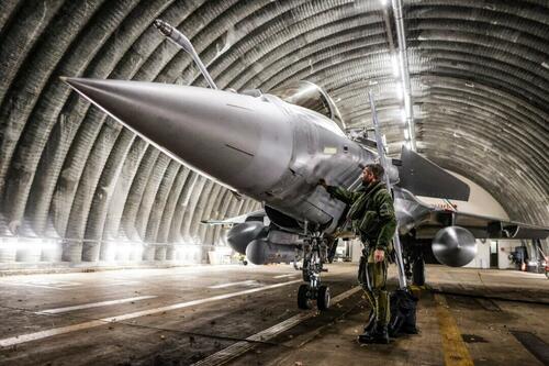
She was speaking as the Ukrainian military claimed Russian forces struck the Ukrainian city of Dnipro with an intercontinental ballistic missile (ICBM) on Nov. 21.
The alleged ICBM strike happened just days after reports emerged the United States had allowed Ukraine to use U.S.-origin long-range weapons for deep strikes inside Russian territory; a request Ukraine’s President Volodymyr Zelenskyy has made for months.
Russia says Ukraine used the Army Tactical Missile Systems (ATACMS) against Russia’s Bryansk region on Nov. 19.
Amid the apparent escalation of the Ukrainian conflict, Lungescu, said: “I would think that there will be a big push towards 3 percent and frankly, we should not need Donald Trump to tell us that we need [to spend] 3 percent.
“Frankly, if there is any change or moderation of the US commitment to Europe … we will need 4 percent and 5 percent of GDP on defense.”
Lungescu said: “Interestingly, there’s a new poll in Germany just the other day showing that 50 percent of those asked said that 3 to 3.5 percent is about right, which is a huge, huge mindset change for Germany.”
In February, Trump told journalists in New York that “NATO countries have to pay up.”
“The United States is in for $2oo billion and they’re in for $25 billion,” he said. “They’re not paying what they should, and they laugh at the stupidity of the United States of America.”
Thursday’s briefing, hosted by the British defense think tank RUSI, was headlined “The impact of the U.S. presidential election on European security.”
Jim Townsend, a former U.S. deputy assistant secretary of defense for European and NATO policy under President Barack Obama, said the world situation was very different from when Trump left office in 2020, partly because of the growing relationship between Russia and China.
Putin Expressing ‘Displeasure’
He said, “There’s a lot of things that Putin is doing right now to express his displeasure over ATACMS sure, but also to message to the incoming administration, ‘don’t think that we’re close friends with you guys and you’re going to roll over us, Trump.’”
Townsend said Russia was angry with the United States and he described the Kremlin’s reaction as: “We’re not happy with the West. We’re not happy with what you’re doing, and you’re going to see our fists about this.”
Max Bergmann, director of the Europe, Russia, and Eurasia program at the Center for Strategic and International Studies (CSIS), described the relationship between Trump and Putin as a “bromance.”
He predicted Sen. Marco Rubio (R-Fla.) would be Trump’s choice for secretary of state, and he pointed out Rubio had voted against President Joe Biden’s $95 billion funding package for Ukraine in February.
Bergmann said the nominations Trump has so far made for his Cabinet suggested that in his second term, “the dial is turned up.”
“It is time to … take Trump very seriously about what he has indicated that he wants to do,” he said.
He added there had been lots of discussions about China’s leader Xi Jinping’s intentions with Taiwan, and “there was a common refrain, ‘You should read what he says and take them literally.’ And I think that’s true with Trump.”
Bergmann said the president-elect wants to fundamentally change U.S. policy on European security, on Ukraine, and Russia.
“I think when it comes to NATO that means basically a major paradigm shift.”
NATO spokesperson Oana Lungescu (L) and NATO Secretary General Jens Stoltenberg arrive for the NATO summit at the Ifema congress centre in Madrid on June 29, 2022. Javier Soriano/AFP via Getty Images
Lungescu, a Romanian former journalist, predicted: “The next four years will be turbulent, will be complicated, and there may be many things that we don’t like.
“But ultimately, if you look at the growing alignment between Russia, China, North Korea, Iran, these authoritarian states, which are all adversaries to what the U.S. stands for, and to what Europeans stand for.
“It’s in our interests to stay calm, to plan, and to invest in what unites us, rather than in what divides us,” she added.
Rutte Is ‘Friend of Trump’
Lungescu said the new NATO secretary general, former Dutch prime minister Mark Rutte, had a “good working relationship with Donald Trump” and described himself as a friend of Trump.
She said, “So I would expect Mark Rutte to try to go to Washington as quickly as possible to meet not just the new administration, but also the new Congress.”
She said bipartisan support for NATO will be part of the calculus in terms of how the administration proceeds.
“He will need to make the case … of why NATO is a good deal for the United States,” added Lungescu, who is now a senior fellow at RUSI.
Lungescu said she thought the NATO summit in The Hague in June would be shorter than originally planned.
She said Trump’s nomination of Matt Whitaker as the next U.S. permanent representative to NATO was “interesting” and “could be a positive sign.”


