Tropical Storm Nadine Public Advisory
…TROPICAL STORM NADINE NEARING LANDFALL IN BELIZE… …HEAVY RAINS AND TROPICAL STORM CONDITIONS SPREADING OVER PARTS OF BELIZE AND THE YUCATAN PENINSULA OF MEXICO…
As of 7:00 AM CDT Sat Oct 19
the center of Nadine was located near 17.3, -87.3
with movement W at 9 mph.
The minimum central pressure was 1002 mb
with maximum sustained winds of about 45 mph.
Tropical Storm Nadine Forecast Advisory
Issued at 0900 UTC SAT OCT 19 2024
Tropical Storm Nadine Public Advisory
…TROPICAL STORM CONDITIONS AND HEAVY RAINS SPREADING OVER PORTIONS OF BELIZE AND THE YUCATAN PENINSULA OF MEXICO…
As of 4:00 AM CDT Sat Oct 19
the center of Nadine was located near 17.4, -87.1
with movement W at 9 mph.
The minimum central pressure was 1004 mb
with maximum sustained winds of about 40 mph.
Tropical Storm Nadine Public Advisory
…TROPICAL STORM NADINE FORMS EAST OF BELIZE… …TROPICAL STORM WARNINGS ISSUED FOR PORTIONS OF BELIZE AND THE YUCATAN PENINSULA OF MEXICO…
As of 1:00 AM CDT Sat Oct 19
the center of Nadine was located near 17.3, -86.4
with movement W at 8 mph.
The minimum central pressure was 1004 mb
with maximum sustained winds of about 40 mph.
Potential Tropical Cyclone Fifteen Public Advisory
…DISTURBANCE FORECAST TO BECOME A TROPICAL STORM BEFORE REACHING THE COAST OF BELIZE ON SATURDAY… …HEAVY RAINFALL EXPECTED WITH FLASH FLOODING POSSIBLE IN PORTIONS OF BELIZE AND SOUTHERN MEXICO THIS WEEKEND…
As of 10:00 PM CDT Fri Oct 18
the center of Fifteen was located near 17.6, -86.1
with movement W at 8 mph.
The minimum central pressure was 1005 mb
with maximum sustained winds of about 35 mph.
Potential Tropical Cyclone Fifteen Public Advisory
…HEAVY RAINFALL EXPECTED WITH FLASH FLOODING POSSIBLE IN PORTIONS OF BELIZE AND SOUTHERN MEXICO THIS WEEKEND… …TROPICAL STORM WATCHES ARE ALSO IN EFFECT…
As of 7:00 PM CDT Fri Oct 18
the center of Fifteen was located near 17.5, -85.7
with movement WNW at 7 mph.
The minimum central pressure was 1005 mb
with maximum sustained winds of about 35 mph.
Potential Tropical Cyclone Fifteen Public Advisory
…POTENTIAL TROPICAL CYCLONE FIFTEEN EXPECTED TO BRING HEAVY RAINFALL TO PORTIONS OF BELIZE AND MEXICO…
As of 4:00 PM CDT Fri Oct 18
the center of Fifteen was located near 17.5, -85.0
with movement WNW at 7 mph.
The minimum central pressure was 1005 mb
with maximum sustained winds of about 35 mph.
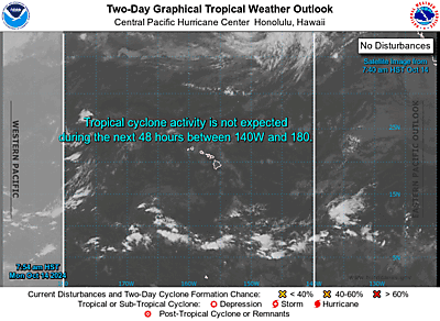
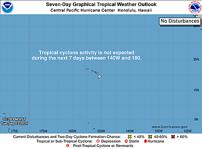
Central Pacific 7-Day Graphical Tropical Weather Outlook
TTAA00 PHFO DDHHMM
Tropical Weather Outlook
NWS Central Pacific Hurricane Center Honolulu HI
800 AM HST Mon Oct 14 2024
For the central North Pacific…between 140W and 180W:
No tropical cyclones are expected during the next 7 days.
$$
Forecaster Foster
NNNN
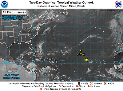
Atlantic 7-Day Graphical Tropical Weather Outlook

TTAA00 KNHC DDHHMM
Tropical Weather Outlook
NWS National Hurricane Center Miami FL
800 AM EDT Mon Oct 14 2024
For the North Atlantic…Caribbean Sea and the Gulf of Mexico:
1. Central Tropical Atlantic (AL94):
A well-defined area of low pressure located several hundred miles
west of the Cabo Verde Islands is producing some disorganized
showers and thunderstorms. This system is currently embedded in a
dry environment, and development is unlikely over the next couple of
days. However, this system is forecast to move generally westward
toward warmer waters, and environmental conditions could become more
favorable for gradual development by the middle to latter part of
this week. A tropical depression could form as the system begins
moving west-northwestward and approaches or moves near the Leeward
Islands late this week.
* Formation chance through 48 hours…low…10 percent.
* Formation chance through 7 days…medium…50 percent.
Forecaster Hagen
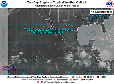
Eastern North Pacific 7-Day Graphical Tropical Weather Outlook

TTAA00 KNHC DDHHMM
Tropical Weather Outlook
NWS National Hurricane Center Miami FL
500 AM PDT Mon Oct 14 2024
For the eastern North Pacific…east of 140 degrees west longitude:
Tropical cyclone formation is not expected during the next 7 days.
$$
Forecaster Blake
NNNN