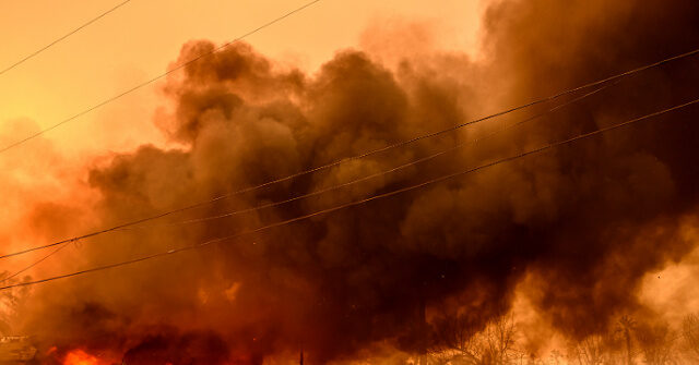
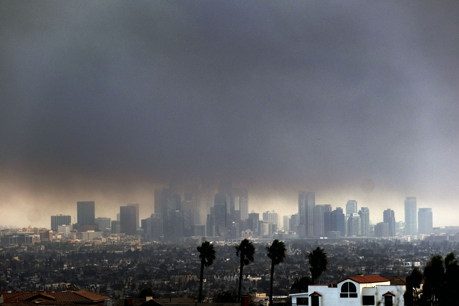
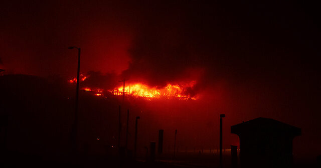
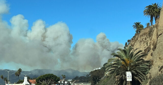
Tropical Depression Ileana Forecast Discussion

Issued at 200 AM MST Sun Sep 15 2024


064
WTPZ44 KNHC 150844
TCDEP4

Tropical Depression Ileana Discussion Number  12
NWS National Hurricane Center Miami FL       EP092024
200 AM MST Sun Sep 15 2024

All of Ileana's deep convection dissipated yesterday afternoon, and
all that is left now is a swirl of low clouds off the coast of
northern Sinaloa.  An ASCAT-C pass from 0410 UTC showed maximum
winds near 30 kt over the Gulf of California near northern Sinaloa,
and a weather station in Topolobampo is no longer reporting winds to
tropical storm force.  As a result, Ileana is now designated as a
30-kt tropical depression, and all coastal warnings in Mexico have
been discontinued.

Ileana has been meandering, but the longer-term motion is
west-northwestward, or 300/2 kt.  Model guidance indicates that the
cyclone should turn northwestward later today but maintain a
generally slow motion while moving over the Gulf of California.
Due to strong southwesterly shear and a very dry atmosphere, deep
convection is not expected to redevelop, and it's likely that
Gordon will be declared a remnant low later this morning.  The
remnant low is expected to dissipate on Monday.


FORECAST POSITIONS AND MAX WINDS

INIT  15/0900Z 25.5N 109.3W   30 KT  35 MPH
 12H  15/1800Z 25.8N 109.8W   25 KT  30 MPH...POST-TROP/REMNT LOW
 24H  16/0600Z 26.5N 110.4W   20 KT  25 MPH...POST-TROP/REMNT LOW
 36H  16/1800Z...DISSIPATED

$$
Forecaster Berg


Tropical Depression Ileana Public Advisory

…ILEANA WEAKENS TO A TROPICAL DEPRESSION… …FORECAST TO BECOME A REMNANT LOW LATER THIS MORNING…
As of 2:00 AM MST Sun Sep 15
the center of Ileana was located near 25.5, -109.3
with movement WNW at 2 mph.
The minimum central pressure was 1006 mb
with maximum sustained winds of about 35 mph.

Tropical Depression Ileana Forecast Advisory

Issued at 0900 UTC SUN SEP 15 2024


376
WTPZ24 KNHC 150843
TCMEP4

TROPICAL DEPRESSION ILEANA FORECAST/ADVISORY NUMBER  12
NWS NATIONAL HURRICANE CENTER MIAMI FL       EP092024
0900 UTC SUN SEP 15 2024

TROPICAL DEPRESSION CENTER LOCATED NEAR 25.5N 109.3W AT 15/0900Z
POSITION ACCURATE WITHIN  20 NM

PRESENT MOVEMENT TOWARD THE WEST-NORTHWEST OR 300 DEGREES AT   2 KT

ESTIMATED MINIMUM CENTRAL PRESSURE 1006 MB
MAX SUSTAINED WINDS  30 KT WITH GUSTS TO  40 KT.
WINDS AND SEAS VARY GREATLY IN EACH QUADRANT.  RADII IN NAUTICAL
MILES ARE THE LARGEST RADII EXPECTED ANYWHERE IN THAT QUADRANT.

REPEAT...CENTER LOCATED NEAR 25.5N 109.3W AT 15/0900Z
AT 15/0600Z CENTER WAS LOCATED NEAR 25.4N 109.3W

FORECAST VALID 15/1800Z 25.8N 109.8W...POST-TROP/REMNT LOW
MAX WIND  25 KT...GUSTS  35 KT.

FORECAST VALID 16/0600Z 26.5N 110.4W...POST-TROP/REMNT LOW
MAX WIND  20 KT...GUSTS  30 KT.

FORECAST VALID 16/1800Z...DISSIPATED

REQUEST FOR 3 HOURLY SHIP REPORTS WITHIN 300 MILES OF 25.5N 109.3W

NEXT ADVISORY AT 15/1500Z

$$
FORECASTER BERG