


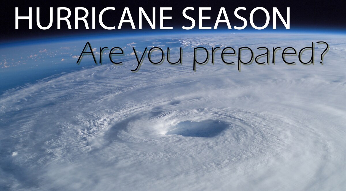
Hurricane Ernesto Public Advisory
000
WTNT35 KNHC 171452
TCPAT5
BULLETIN
Hurricane Ernesto Advisory Number 24
NATIONAL WEATHER SERVICE, National Hurricane Center Miami FLORIDA AL052024
11:00 A.M. ATLANTIC STANDARD TIME Sat Aug 17 2024
- HAZARDOUS WEATHER STILL OCCURING ON BERMUDA AS ERNESTO MOVES SLOWLY NORTH NORTHEASTWARD
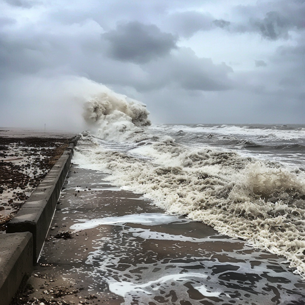
- DANGEROUS BEACH CONDITIONS TO CONTINUE ALONG THE U.S. EAST COAST THROUGH EARLY NEXT WEEK
SUMMARY OF 11:00 A.M. ATLANTIC STANDARD TIME 15:00 COORDINATED UNIVERSAL TIME INFORMATION
LOCATION 32.9 NORTH 64.4 WEST
ABOUT 50 MILES, 75 KILOMETERS NORTH NORTHEAST, OF BERMUDA
ABOUT 1125 MILES, 1805 KILOMETERS SOUTHWEST, OF CAPE RACE NEWFOUNDLAND
MAXIMUM SUSTAINED WINDS 80 MILES PER HOUR, 130 KILOMETERS PER HOUR
PRESENT MOVEMENT NORTH NORTHEAST, OR 25 DEGREES AT 9 MILES PER HOUR, 15 KILOMETERS PER HOUR
MINIMUM CENTRAL PRESSURE 974 MILLIBAR, 28.77 INCHES
WATCHES AND WARNINGS
CHANGES WITH THIS ADVISORY: None.
SUMMARY OF WATCHES AND WARNINGS IN EFFECT:
A Hurricane Warning is in effect for
- Bermuda
- A Hurricane Warning means that hurricane conditions are expected somewhere within the warning area.
- Interests in southeastern Newfoundland should monitor the progress of Ernesto.
- For storm information specific to your area, please monitor products issued by your national meteorological service.
DISCUSSION AND OUTLOOK
- At 11:00 A.M. ATLANTIC STANDARD TIME (15:00 COORDINATED UNIVERSAL TIME), the center of Hurricane Ernesto was located near latitude 32.9 North, longitude 64.4 West.
- Ernesto is moving toward the north northeast near 9 Miles Per Hour, (15 Kilometers Per Hour), and this general motion is expected to continue through early Sunday.
- An acceleration toward the north northeast should begin on Sunday, with a turn toward the northeast and east northeast occurring late Monday into Tuesday.
- On the forecast track, the center of Ernesto will slowly move away from Bermuda today and pass near southeastern Newfoundland late Monday and Monday night.
- Data from an Air Force Reserve Hurricane Hunter aircraft indicate that maximum sustained winds are near 80 Miles Per Hour, (130 Kilometers Per Hour) with higher gusts.
- Little change in strength is forecast during the next 48 hours.
- Hurricane force winds extend outward up to 70 miles (110 Kilometers) from the center and tropical storm force winds extend outward up to 240 miles (390 Kilometers).
- An elevated weather station at the National Museum of Bermuda recently reported a sustained wind of 62 Miles Per Hour, (100 Kilometers Per Hour) and a gust to 82 Miles Per Hour, (132 Kilometers Per Hour).
- The estimated minimum central pressure is 974 Millibar, (28.77 inches).
HAZARDS AFFECTING LAND
Key messages for Ernesto can be found in the Tropical Cyclone Discussion under AWIPS header MIATCDAT5 and WMO header WTNT45 KNHC and on the web at
hurricanes.gov/text/MIATCDAT5.shtml
WIND:
- Hurricane force gusts are possible on Bermuda for a few more hours.
- Tropical storm conditions are likely to continue through this evening or tonight.
STORM SURGE:
- Significant coastal flooding is still possible on Bermuda in areas of onshore winds.
- Near the coast, the surge will be accompanied by large and destructive waves.
RAINFALL:
- Ernesto is expected to produce total rain accumulations of 6 to 9 inches or 150 to 225 milimeter in Bermuda.
- This rainfall will likely result in considerable life threatening flash flooding, especially in low lying areas on the island.
SURF:
- Swells generated by Ernesto are affecting portions of the Bahamas, Bermuda, and the east coast of the United States and will reach portions of Atlantic Canada today.
- Life threatening surf and rip current conditions are likely in these areas during the next couple of days.
- Please consult products from your local weather office, and stay out of the water if advised by lifeguards.
NEXT ADVISORY
- Next intermediate advisory at 2:00 P.M. ATLANTIC STANDARD TIME.
- Next complete advisory at 5:00 P.M. ATLANTIC STANDARD TIME.
$$
Forecaster Berg
Originally Posted at:
NATIONAL HURRICANE CENTER and CENTRAL PACIFIC HURRICANE CENTER
At The NATIONAL OCEANIC AND ATMOSPHERIC ADMINISTRATION
Stay Updated with news.freeptomaineradio.com’s Daily Newsletter
Stay informed! Subscribe to our daily newsletter to receive updates on our latest blog posts directly in your inbox. Don’t let important information get buried by big tech.
Current subscribers:
Hurricane Ernesto Forecast Advisory
000
WTNT25 KNHC 171452
TCMAT5

HURRICANE ERNESTO FORECAST/ADVISORY NUMBER  24
NWS NATIONAL HURRICANE CENTER MIAMI FL       AL052024
1500 UTC SAT AUG 17 2024

HURRICANE CENTER LOCATED NEAR 32.9N  64.4W AT 17/1500Z
POSITION ACCURATE WITHIN  20 NM

PRESENT MOVEMENT TOWARD THE NORTH-NORTHEAST OR  25 DEGREES AT   8 KT

ESTIMATED MINIMUM CENTRAL PRESSURE  974 MB
MAX SUSTAINED WINDS  70 KT WITH GUSTS TO  85 KT.
64 KT....... 60NE  60SE  30SW  40NW.
50 KT.......120NE 100SE  80SW 100NW.
34 KT.......200NE 210SE 110SW 160NW.
12 FT SEAS..320NE 280SE 260SW 280NW.
WINDS AND SEAS VARY GREATLY IN EACH QUADRANT.  RADII IN NAUTICAL
MILES ARE THE LARGEST RADII EXPECTED ANYWHERE IN THAT QUADRANT.

REPEAT...CENTER LOCATED NEAR 32.9N  64.4W AT 17/1500Z
AT 17/1200Z CENTER WAS LOCATED NEAR 32.6N  64.5W

FORECAST VALID 18/0000Z 33.7N  63.9W
MAX WIND  65 KT...GUSTS  80 KT.
64 KT... 50NE  50SE  30SW   0NW.
50 KT... 80NE  80SE  50SW  50NW.
34 KT...180NE 180SE 110SW 140NW.

FORECAST VALID 18/1200Z 35.3N  63.3W
MAX WIND  65 KT...GUSTS  80 KT.
64 KT... 40NE  40SE  30SW   0NW.
50 KT... 70NE  80SE  50SW  50NW.
34 KT...150NE 160SE 120SW 120NW.

FORECAST VALID 19/0000Z 37.9N  62.0W
MAX WIND  65 KT...GUSTS  80 KT.
64 KT... 30NE  35SE  20SW   0NW.
50 KT... 70NE  80SE  50SW  40NW.
34 KT...150NE 170SE 120SW 100NW.

FORECAST VALID 19/1200Z 41.3N  59.5W
MAX WIND  70 KT...GUSTS  85 KT.
64 KT... 30NE  35SE  20SW   0NW.
50 KT... 70NE  80SE  50SW  40NW.
34 KT...150NE 180SE 130SW  90NW.

FORECAST VALID 20/0000Z 44.9N  54.7W
MAX WIND  60 KT...GUSTS  75 KT.
50 KT... 60NE  80SE  50SW   0NW.
34 KT...140NE 180SE 160SW  70NW.

FORECAST VALID 20/1200Z 47.7N  47.2W...POST-TROP/EXTRATROP
MAX WIND  50 KT...GUSTS  60 KT.
50 KT... 30NE  50SE  30SW   0NW.
34 KT...110NE 180SE 180SW  30NW.

EXTENDED OUTLOOK. NOTE...ERRORS FOR TRACK HAVE AVERAGED NEAR 125 NM
ON DAY 4 AND 175 NM ON DAY 5...AND FOR INTENSITY NEAR 15 KT EACH DAY

OUTLOOK VALID 21/1200Z 51.2N  27.8W...POST-TROP/EXTRATROP
MAX WIND  35 KT...GUSTS  45 KT.
34 KT... 30NE  90SE  50SW   0NW.

OUTLOOK VALID 22/1200Z...DISSIPATED

REQUEST FOR 3 HOURLY SHIP REPORTS WITHIN 300 MILES OF 32.9N  64.4W

INTERMEDIATE PUBLIC ADVISORY...WTNT35 KNHC/MIATCPAT5...AT 17/1800Z

NEXT ADVISORY AT 17/2100Z

$$
FORECASTER BERG
Originally Posted at:
NATIONAL HURRICANE CENTER and CENTRAL PACIFIC HURRICANE CENTER
At The NATIONAL OCEANIC AND ATMOSPHERIC ADMINISTRATION
Stay Updated with news.freeptomaineradio.com’s Daily Newsletter
Stay informed! Subscribe to our daily newsletter to receive updates on our latest blog posts directly in your inbox. Don’t let important information get buried by big tech.
Current subscribers:

JOBOB: Majority of Americans believe US is currently in a recession: poll
A recent poll has found that a majority of Americans believe the US is currently in a recession, citing concerns regarding ongoing inflation and high interest rates.
The survey, conducted by Affirm in June and involving 2,000 adults, found that 59 percent of respondents consider the American economy to be in a recession. Many respondents indicated that they believe the recession began around March 2023 and expect it to persist until the summer of next year.
Inflation and the rising cost of living were cited as the primary reasons for this belief. A significant 68 percent of those surveyed said inflation is negatively impacting their future plans and their ability to afford upcoming purchases. Vishal Kapoor, Senior Vice President of Product at Affirm, commented on the findings, saying, “With confidence in the U.S. economy at a low point, consumers are urgently seeking ways to feel in control of their finances.”
“Amidst these levels of uncertainty and doubt, we believe that the antidote to the current ‘vibecession’ is greater choice and transparency in how people manage their finances,” Kapoor added.
The poll also found that 54 percent of respondents have used or would consider using “buy now, pay later” options, with 45 percent agreeing that such options make it easier to manage their finances.
Officially, the US is not in a recession, which is traditionally defined by economists as two consecutive quarters of negative GDP growth. However, this definition has come under scrutiny, particularly when the White House disputed it in 2022 when the economy did, in fact, see two quarters of negative growth.
Regardless of the official status, the fact that a majority of Americans feel the economy is in a recession reflects the challenges faced by the average citizen. A recent CNN poll also highlighted growing concerns, with nearly four in ten Americans worried that their family income may not be sufficient to cover all expenses—a higher percentage than during the 2008 recession.
This piece first appeared at TPUSA.
This Story originally came from humanevents.com
Stay Updated with news.freeptomaineradio.com’s Daily Newsletter
Stay informed! Subscribe to our daily newsletter to receive updates on our latest blog posts directly in your inbox. Don’t let important information get buried by big tech.
Current subscribers:
Hurricane Ernesto Public Advisory
000
WTNT35 KNHC 171155
TCPAT5
BULLETIN
Hurricane Ernesto Intermediate Advisory Number 23A
NATIONAL WEATHER SERVICE, National Hurricane Center Miami FLORIDA AL052024
8:00 A.M. ATLANTIC STANDARD TIME Sat Aug 17 2024
- ERNESTO’SOUTH, CENTER BEGINNING TO MOVE AWAY FROM BERMUDA AND WINDS HAVE PICKED BACK UP ON THE ISLAND
- HAZARDOUS CONDITIONS WILL CONTINUE ON BERMUDA THROUGH THIS EVENING
SUMMARY OF 8:00 A.M. ATLANTIC STANDARD TIME 12:00 COORDINATED UNIVERSAL TIME INFORMATION
LOCATION 32.6 NORTH 64.6 WEST
ABOUT 15 MILES, 25 KILOMETERS NORTH NORTHEAST, OF BERMUDA
MAXIMUM SUSTAINED WINDS 85 MILES PER HOUR, 140 KILOMETERS PER HOUR
PRESENT MOVEMENT NORTH NORTHEAST, OR 20 DEGREES AT 9 MILES PER HOUR, 15 KILOMETERS PER HOUR
MINIMUM CENTRAL PRESSURE 974 MILLIBAR, 28.76 INCHES
WATCHES AND WARNINGS
CHANGES WITH THIS ADVISORY: None.
SUMMARY OF WATCHES AND WARNINGS IN EFFECT:
A Hurricane Warning is in effect for
- Bermuda
- A Hurricane Warning means that hurricane conditions are expected somewhere within the warning area.
Interests in Atlantic Canada should monitor the progress of Ernesto. - For storm information specific to your area, please monitor products issued by your national meteorological service.
DISCUSSION AND OUTLOOK
- At 8:00 A.M. ATLANTIC STANDARD TIME (12:00 COORDINATED UNIVERSAL TIME), the center of Hurricane Ernesto was located near latitude 32.6 North, longitude 64.6 West.
Ernesto is moving toward the north northeast near 9 Miles Per Hour, (15 Kilometers Per Hour), and this general motion is expected today.
A faster northeastward motion is then expected late this weekend into early next week.
On the forecast track, the center of Ernesto is expected to slowly depart Bermuda today and move near or east of Newfoundland Monday night.
Maximum sustained winds are near 85 Miles Per Hour, (140 Kilometers Per Hour) with higher gusts.
Little change in strength is forecast today.
Some re intensification is possible late in the weekend before weakening begins on Monday.
Ernesto is a large tropical cyclone.
Hurricane force winds extend outward up to 70 miles (110 Kilometers) from the center and tropical storm force winds extend outward up to 240 miles (390 Kilometers).
The estimated minimum central pressure based on dropsonde data is 974 Millibar, (28.76 inches).
HAZARDS AFFECTING LAND
Key messages for Ernesto can be found in the Tropical Cyclone Discussion under AWIPS header MIATCDAT5 and WMO header WTNT45 KNHC and on the web at
hurricanes.gov/text/MIATCDAT5.shtml
WIND:
Hurricane conditions are expected on Bermuda through the next several hours.
Due to Ernesto’s large size and slow motion, strong winds will continue on the island through most of today into this evening.
STORM SURGE:
A dangerous storm surge is expected to produce significant coastal flooding on Bermuda in areas of onshore winds.
Near the coast, the surge will be accompanied by large and destructive waves.
RAINFALL:
Ernesto is expected to produce total rain accumulations of 6 to 9 inches or 150 to 225 milimeter on Bermuda.
This rainfall will likely result in considerable life threatening flash flooding, especially in low lying areas on the island.
SURF:
Swells generated by Ernesto are affecting portions of the the Bahamas, Bermuda, and the east coast of the United States.
These swells will likely reach portions of Atlantic Canada today.
Life threatening surf and rip current conditions are likely in these areas during the next couple of days.
Please consult products from your local weather office, and stay out of the water if advised by lifeguards.
NEXT ADVISORY
Next complete advisory at 11:00 A.M. ATLANTIC STANDARD TIME.
$$
Forecaster Berg
Originally Posted at:
NATIONAL HURRICANE CENTER and CENTRAL PACIFIC HURRICANE CENTER
At The NATIONAL OCEANIC AND ATMOSPHERIC ADMINISTRATION
Stay Updated with news.freeptomaineradio.com’s Daily Newsletter
Stay informed! Subscribe to our daily newsletter to receive updates on our latest blog posts directly in your inbox. Don’t let important information get buried by big tech.
Current subscribers:
Hurricane Ernesto Public Advisory
000
WTNT35 KNHC 170855
TCPAT5

BULLETIN
Hurricane Ernesto Advisory Number  23
NWS National Hurricane Center Miami FL       AL052024
500 AM AST Sat Aug 17 2024

...ERNESTO MAKES LANDFALL ON BERMUDA...
...STRONG WINDS, DANGEROUS STORM SURGE, AND LIFE-THREATENING
FLOODING EXPECTED TO CONTINUE ON BERMUDA TODAY...


SUMMARY OF 500 AM AST...0900 UTC...INFORMATION
----------------------------------------------
LOCATION...32.3N 64.8W
ABOUT 0 MI...0 KM N OF BERMUDA
MAXIMUM SUSTAINED WINDS...85 MPH...140 KM/H
PRESENT MOVEMENT...NNE OR 20 DEGREES AT 9 MPH...15 KM/H
MINIMUM CENTRAL PRESSURE...972 MB...28.71 INCHES


WATCHES AND WARNINGS
--------------------
CHANGES WITH THIS ADVISORY:

None.

SUMMARY OF WATCHES AND WARNINGS IN EFFECT:

A Hurricane Warning is in effect for...
* Bermuda

A Hurricane Warning means that hurricane conditions are expected
somewhere within the warning area.

Interests in Atlantic Canada should monitor the progress of Ernesto.

For storm information specific to your area, please monitor
products issued by your national meteorological service.


DISCUSSION AND OUTLOOK
----------------------
Surface observations indicate that Ernesto made landfall on the
western side of Bermuda around 430 AM AST (0830 UTC). At 500 AM AST
(0900 UTC), the center of Hurricane Ernesto was located near
latitude 32.3 North, longitude 64.8 West. Ernesto is moving toward
the north-northeast near 9 mph (15 km/h), and this general motion is
expected today.  A faster northeastward motion is then expected late
this weekend into early next week.  On the forecast track, the
center of Ernesto is expected to slowly depart Bermuda today and
move near or east of Newfoundland Monday night.

Maximum sustained winds have decreased to near 85 mph (140 km/h)
with higher gusts.  Little change in strength is forecast today.
Some re-intensification is possible late in the weekend before
weakening begins on Monday.

Ernesto is a large tropical cyclone. Hurricane-force winds extend
outward up to 70 miles (110 km) from the center and tropical-storm-
force winds extend outward up to 240 miles (390 km).

The estimated minimum central pressure is 972 mb (28.71 inches).
The National Museum on Bermuda recently reported a central pressure
of 972 mb (28.71 mb).


HAZARDS AFFECTING LAND
----------------------
Key messages for Ernesto can be found in the Tropical Cyclone
Discussion under AWIPS header MIATCDAT5 and WMO header WTNT45 KNHC
and on the web at hurricanes.gov/text/MIATCDAT5.shtml.

WIND:  Hurricane conditions are expected on Bermuda through the
next several hours.  Due to Ernesto's large size and slow motion,
strong winds will continue on the island through most of today.

STORM SURGE: A dangerous storm surge is expected to produce
significant coastal flooding on Bermuda in areas of onshore winds.
Near the coast, the surge will be accompanied by large and
destructive waves.

RAINFALL: Ernesto is expected to produce total rain accumulations of
6 to 9 inches or 150 to 225 mm on Bermuda. This rainfall will likely
result in considerable life-threatening flash flooding, especially
in low-lying areas on the island.

SURF: Swells generated by Ernesto are affecting portions of the the
Bahamas, Bermuda, and the east coast of the United States. These
swells will likely reach portions of Atlantic Canada by tonight.
Life-threatening surf and rip current conditions are likely in these
areas during the next couple of days.  Please consult products from
your local weather office, and stay out of the water if advised by
lifeguards.


NEXT ADVISORY
-------------
Next intermediate advisory at 800 AM AST.
Next complete advisory at 1100 AM AST.

$$
Forecaster Blake
Originally Posted at:
NATIONAL HURRICANE CENTER and CENTRAL PACIFIC HURRICANE CENTER
At The NATIONAL OCEANIC AND ATMOSPHERIC ADMINISTRATION
Stay Updated with news.freeptomaineradio.com’s Daily Newsletter
Stay informed! Subscribe to our daily newsletter to receive updates on our latest blog posts directly in your inbox. Don’t let important information get buried by big tech.
Current subscribers:
Hurricane Ernesto Forecast Advisory
000
WTNT25 KNHC 170855
TCMAT5

HURRICANE ERNESTO FORECAST/ADVISORY NUMBER  23
NWS NATIONAL HURRICANE CENTER MIAMI FL       AL052024
0900 UTC SAT AUG 17 2024

HURRICANE CENTER LOCATED NEAR 32.3N  64.8W AT 17/0900Z
POSITION ACCURATE WITHIN  20 NM

PRESENT MOVEMENT TOWARD THE NORTH-NORTHEAST OR  20 DEGREES AT   8 KT

ESTIMATED MINIMUM CENTRAL PRESSURE  972 MB
MAX SUSTAINED WINDS  75 KT WITH GUSTS TO  90 KT.
64 KT....... 60NE  60SE  30SW  40NW.
50 KT....... 90NE 100SE  60SW  80NW.
34 KT.......150NE 210SE 110SW 150NW.
12 FT SEAS..270NE 285SE 270SW 270NW.
WINDS AND SEAS VARY GREATLY IN EACH QUADRANT.  RADII IN NAUTICAL
MILES ARE THE LARGEST RADII EXPECTED ANYWHERE IN THAT QUADRANT.

REPEAT...CENTER LOCATED NEAR 32.3N  64.8W AT 17/0900Z
AT 17/0600Z CENTER WAS LOCATED NEAR 32.0N  65.0W

FORECAST VALID 17/1800Z 33.3N  64.4W
MAX WIND  70 KT...GUSTS  85 KT.
64 KT... 40NE  40SE  30SW  30NW.
50 KT... 60NE  60SE  50SW  50NW.
34 KT...160NE 190SE 100SW 140NW.

FORECAST VALID 18/0600Z 34.6N  63.9W
MAX WIND  70 KT...GUSTS  85 KT.
64 KT... 40NE  40SE  30SW  30NW.
50 KT... 60NE  60SE  50SW  50NW.
34 KT...160NE 190SE 100SW 140NW.

FORECAST VALID 18/1800Z 36.6N  62.9W
MAX WIND  75 KT...GUSTS  90 KT.
64 KT... 30NE  40SE  20SW  30NW.
50 KT... 60NE  70SE  40SW  40NW.
34 KT...160NE 160SE 110SW 100NW.

FORECAST VALID 19/0600Z 39.8N  61.2W
MAX WIND  80 KT...GUSTS 100 KT.
64 KT... 30NE  40SE  20SW  20NW.
50 KT... 70NE  70SE  40SW  40NW.
34 KT...150NE 180SE 120SW  90NW.

FORECAST VALID 19/1800Z 43.5N  57.5W
MAX WIND  70 KT...GUSTS  85 KT.
50 KT... 60NE  80SE  50SW  30NW.
34 KT...140NE 180SE 150SW  80NW.

FORECAST VALID 20/0600Z 47.0N  51.5W...POST-TROPICAL
MAX WIND  60 KT...GUSTS  75 KT.
50 KT... 30NE  50SE  40SW   0NW.
34 KT...130NE 180SE 170SW  50NW.

EXTENDED OUTLOOK. NOTE...ERRORS FOR TRACK HAVE AVERAGED NEAR 125 NM
ON DAY 4 AND 175 NM ON DAY 5...AND FOR INTENSITY NEAR 15 KT EACH DAY

OUTLOOK VALID 21/0600Z 51.5N  32.0W...POST-TROP/EXTRATROP
MAX WIND  40 KT...GUSTS  50 KT.
34 KT... 30NE 150SE 130SW   0NW.

OUTLOOK VALID 22/0600Z...DISSIPATED

REQUEST FOR 3 HOURLY SHIP REPORTS WITHIN 300 MILES OF 32.3N  64.8W

INTERMEDIATE PUBLIC ADVISORY...WTNT35 KNHC/MIATCPAT5...AT 17/1200Z

NEXT ADVISORY AT 17/1500Z

$$
FORECASTER BLAKE
Originally Posted at:
NATIONAL HURRICANE CENTER and CENTRAL PACIFIC HURRICANE CENTER
At The NATIONAL OCEANIC AND ATMOSPHERIC ADMINISTRATION
Stay Updated with news.freeptomaineradio.com’s Daily Newsletter
Stay informed! Subscribe to our daily newsletter to receive updates on our latest blog posts directly in your inbox. Don’t let important information get buried by big tech.
Current subscribers:
Hurricane Ernesto Public Advisory
000
WTNT35 KNHC 170555
TCPAT5

BULLETIN
Hurricane Ernesto Intermediate Advisory Number 22A
NWS National Hurricane Center Miami FL       AL052024
200 AM AST Sat Aug 17 2024

...ERNESTO LASHING BERMUDA WITH STRONG WINDS, DANGEROUS STORM
SURGE, AND LIFE-THREATENING FLOODING...


SUMMARY OF 200 AM AST...0600 UTC...INFORMATION
----------------------------------------------
LOCATION...32.0N 65.1W
ABOUT 25 MI...40 KM SW OF BERMUDA
MAXIMUM SUSTAINED WINDS...90 MPH...150 KM/H
PRESENT MOVEMENT...NNE OR 30 DEGREES AT 13 MPH...20 KM/H
MINIMUM CENTRAL PRESSURE...972 MB...28.70 INCHES


WATCHES AND WARNINGS
--------------------
CHANGES WITH THIS ADVISORY:

None.

SUMMARY OF WATCHES AND WARNINGS IN EFFECT:

A Hurricane Warning is in effect for...
* Bermuda

A Hurricane Warning means that hurricane conditions are expected
somewhere within the warning area.

For storm information specific to your area, please monitor
products issued by your national meteorological service.


DISCUSSION AND OUTLOOK
----------------------
At 200 AM AST (0600 UTC), the center of Hurricane Ernesto was
located near latitude 32.0 North, longitude 65.1 West. Ernesto is
moving toward the north-northeast near 13 mph (20 km/h). A gradual
slowdown is expected during the next day or so.  An accelerating
northeastward motion is then expected late this weekend into early
next week.  On the forecast track, the center of Ernesto is expected
to pass near or over Bermuda within a few hours and near or east of
Newfoundland Monday night.

Maximum sustained winds remain near 90 mph (150 km/h) with higher
gusts. Some gradual weakening is forecast over the next day or so,
though some re-intensification is possible late in the weekend.

Ernesto is a large tropical cyclone. Hurricane-force winds extend
outward up to 70 miles (110 km) from the center and tropical-
storm-force winds extend outward up to 275 miles (445 km). The L.
F. Wade International Airport on Bermuda recently reported
sustained winds of 61 mph (98 km/h) with a gust to 84 mph (135
km/h).

The estimated minimum central pressure based on data from an Air
Force Hurricane Hunter aircraft is 972 mb (28.70 inches).


HAZARDS AFFECTING LAND
----------------------
Key messages for Ernesto can be found in the Tropical Cyclone
Discussion under AWIPS header MIATCDAT5 and WMO header WTNT45 KNHC
and on the web at hurricanes.gov/text/MIATCDAT5.shtml.

WIND:  Hurricane conditions are expected on Bermuda through the
next several hours.  Due to Ernesto's large size and slow motion,
strong winds will continue on the island through most of today.

STORM SURGE: A dangerous storm surge is expected to produce
significant coastal flooding on Bermuda in areas of onshore winds.
Near the coast, the surge will be accompanied by large and
destructive waves.

RAINFALL: Ernesto is expected to produce total rain accumulations of
6 to 9 inches or 150 to 225 mm on Bermuda. This rainfall will likely
result in considerable life-threatening flash flooding, especially
in low-lying areas on the island.

SURF: Swells generated by Ernesto are affecting portions of the
the Bahamas, Bermuda, and the east coast of the United States.
These swells will likely reach portions of Atlantic Canada by
tonight.  Life-threatening surf and rip current conditions are
likely in these areas during the next couple of days.  Please
consult products from your local weather office, and stay out of
the water if advised by lifeguards.


NEXT ADVISORY
-------------
Next complete advisory at 500 AM AST.

$$
Forecaster Blake
Originally Posted at:
NATIONAL HURRICANE CENTER and CENTRAL PACIFIC HURRICANE CENTER
At The NATIONAL OCEANIC AND ATMOSPHERIC ADMINISTRATION
Stay Updated with news.freeptomaineradio.com’s Daily Newsletter
Stay informed! Subscribe to our daily newsletter to receive updates on our latest blog posts directly in your inbox. Don’t let important information get buried by big tech.
Current subscribers:
Hurricane Ernesto Public Advisory
000
WTNT35 KNHC 170231
TCPAT5

BULLETIN
Hurricane Ernesto Advisory Number  22
NWS National Hurricane Center Miami FL       AL052024
1100 PM AST Fri Aug 16 2024

...ERNESTO VERY NEAR BERMUDA...
...STRONG WINDS, DANGEROUS STORM SURGE, AND LIFE-THREATENING
FLOODING OCCURRING ON THE ISLAND...


SUMMARY OF 1100 PM AST...0300 UTC...INFORMATION
-----------------------------------------------
LOCATION...31.4N 65.2W
ABOUT 65 MI...105 KM SSW OF BERMUDA
MAXIMUM SUSTAINED WINDS...90 MPH...150 KM/H
PRESENT MOVEMENT...NNE OR 30 DEGREES AT 13 MPH...20 KM/H
MINIMUM CENTRAL PRESSURE...969 MB...28.62 INCHES


WATCHES AND WARNINGS
--------------------
CHANGES WITH THIS ADVISORY:

None.

SUMMARY OF WATCHES AND WARNINGS IN EFFECT:

A Hurricane Warning is in effect for...
* Bermuda

A Hurricane Warning means that hurricane conditions are expected
somewhere within the warning area.

For storm information specific to your area, please monitor
products issued by your national meteorological service.


DISCUSSION AND OUTLOOK
----------------------
At 1100 PM AST (0300 UTC), the center of Hurricane Ernesto was
located near latitude 31.4 North, longitude 65.2 West. Ernesto is
moving toward the north-northeast near 13 mph (20 km/h). A gradual
slowdown is expected during the next day or so.  An accelerating
northeastward motion is then expected late this weekend into early
next week.  On the forecast track, the center of Ernesto is expected
to pass near or over Bermuda Saturday morning and near or east of
Newfoundland Monday night.

Maximum sustained winds are near 90 mph (150 km/h) with higher
gusts. Some gradual weakening is forecast over the next day or so,
though some re-intensification is possible late in the weekend.

Ernesto is a large tropical cyclone. Hurricane-force winds extend
outward up to 70 miles (110 km) from the center and
tropical-storm-force winds extend outward up to 275 miles (445 km).
The Bermuda International Airport recently reported sustained winds
of 52 mph (84 km/h) with a gust to 74 mph (120 km/h).

The estimated minimum central pressure based on data from an Air
Force Hurricane Hunter aircraft is 969 mb (28.62 inches).


HAZARDS AFFECTING LAND
----------------------
Key messages for Ernesto can be found in the Tropical Cyclone
Discussion under AWIPS header MIATCDAT5 and WMO header WTNT45 KNHC
and on the web at hurricanes.gov/text/MIATCDAT5.shtml.

WIND: Winds on Bermuda are expected to increase to hurricane force
early Saturday.  Due to Ernesto's large size and slow motion, strong
winds will continue on the island into Saturday night.

STORM SURGE: A dangerous storm surge is expected to produce
significant coastal flooding on Bermuda in areas of onshore winds.
Near the coast, the surge will be accompanied by large and
destructive waves.

RAINFALL: Ernesto is expected to produce total rain accumulations of
6 to 9 inches or 150 to 225 mm on Bermuda. This rainfall will likely
result in considerable life-threatening flash flooding, especially
in low-lying areas on the island.

SURF: Swells generated by Ernesto are affecting portions of the
the Bahamas, Bermuda, and the east coast of the United States.
These swells will likely reach portions of Atlantic Canada by late
Saturday.  Life-threatening surf and rip current conditions are
likely in these areas during the next couple of days.  Please
consult products from your local weather office, and stay out of
the water if advised by lifeguards.


NEXT ADVISORY
-------------
Next intermediate advisory at 200 AM AST.
Next complete advisory at 500 AM AST.

$$
Forecaster Cangialosi
Originally Posted at:
NATIONAL HURRICANE CENTER and CENTRAL PACIFIC HURRICANE CENTER
At The NATIONAL OCEANIC AND ATMOSPHERIC ADMINISTRATION
Stay Updated with news.freeptomaineradio.com’s Daily Newsletter
Stay informed! Subscribe to our daily newsletter to receive updates on our latest blog posts directly in your inbox. Don’t let important information get buried by big tech.
Current subscribers:
Hurricane Ernesto Public Advisory
969
WTNT35 KNHC 162348
TCPAT5

BULLETIN
Hurricane Ernesto Intermediate Advisory Number 21A
NWS National Hurricane Center Miami FL       AL052024
800 PM AST Fri Aug 16 2024

...STRONG WINDS, DANGEROUS STORM SURGE, AND LIFE-THREATENING
FLOODING BEGINNING OVER BERMUDA...


SUMMARY OF 800 PM AST...0000 UTC...INFORMATION
----------------------------------------------
LOCATION...31.0N 65.2W
ABOUT 95 MI...150 KM SSW OF BERMUDA
MAXIMUM SUSTAINED WINDS...100 MPH...155 KM/H
PRESENT MOVEMENT...NE OR 35 DEGREES AT 13 MPH...20 KM/H
MINIMUM CENTRAL PRESSURE...969 MB...28.62 INCHES


WATCHES AND WARNINGS
--------------------
CHANGES WITH THIS ADVISORY:

None.

SUMMARY OF WATCHES AND WARNINGS IN EFFECT:

A Hurricane Warning is in effect for...
* Bermuda

A Hurricane Warning means that hurricane conditions are expected
somewhere within the warning area.

For storm information specific to your area, please monitor
products issued by your national meteorological service.


DISCUSSION AND OUTLOOK
----------------------
At 800 PM AST (0000 UTC), the center of Hurricane Ernesto was
located near latitude 31.0 North, longitude 65.2 West. Ernesto is
moving toward the northeast near 13 mph (20 km/h). This general
motion is expected to continue with a gradual slowdown beginning
early Saturday.  An accelerating northeastward motion is then
expected late this weekend into early next week.  On the forecast
track, the center of Ernesto is expected to pass near or over
Bermuda Saturday morning and near or east of Newfoundland Monday
night.

Maximum sustained winds remain near 100 mph (155 km/h) with higher
gusts. Some gradual weakening is forecast over the next day or so,
though some re-intensification is possible late in the weekend.

Ernesto is a large tropical cyclone. Hurricane-force winds extend
outward up to 75 miles (120 km) from the center and
tropical-storm-force winds extend outward up to 275 miles (445 km).
The Bermuda International Airport recently reported sustained winds
of 41 mph (66 km/h) with a gust to 50 mph (81 km/h).  A Saildrone
(SD-1068) recently reported a sustained wind of 68 mph (111 km/h)
and a wind gust of 94 mph (152 km/h).

The estimated minimum central pressure is 969 mb (28.62 inches).


HAZARDS AFFECTING LAND
----------------------
Key messages for Ernesto can be found in the Tropical Cyclone
Discussion under AWIPS header MIATCDAT5 and WMO header WTNT45 KNHC
and on the web at hurricanes.gov/text/MIATCDAT5.shtml.

WIND: Winds on Bermuda are expected to increase to hurricane force
early Saturday.  Due to Ernesto's large size and slow motion, strong
winds will continue on the island into Saturday night.

STORM SURGE: A dangerous storm surge is expected to produce
significant coastal flooding on Bermuda in areas of onshore winds.
Near the coast, the surge will be accompanied by large and
destructive waves.

RAINFALL: Ernesto is expected to produce total rain accumulations of
6 to 9 inches or 150 to 225 mm on Bermuda. This rainfall will likely
result in considerable life-threatening flash flooding, especially
in low-lying areas on the island.

SURF: Swells generated by Ernesto are affecting portions of the
the Bahamas, Bermuda, and the east coast of the United States.
These swells will likely reach portions of Atlantic Canada by late
Saturday.  Life-threatening surf and rip current conditions are
likely in these areas during the next couple of days.  Please
consult products from your local weather office, and stay out of
the water if advised by lifeguards.


NEXT ADVISORY
-------------
Next complete advisory at 1100 PM AST.

$$
Forecaster Cangialosi
Originally Posted at:
NATIONAL HURRICANE CENTER and CENTRAL PACIFIC HURRICANE CENTER
At The NATIONAL OCEANIC AND ATMOSPHERIC ADMINISTRATION
Stay Updated with news.freeptomaineradio.com’s Daily Newsletter
Stay informed! Subscribe to our daily newsletter to receive updates on our latest blog posts directly in your inbox. Don’t let important information get buried by big tech.
Current subscribers:

Somali migrant who beheaded and stabbed victim 111 times could avoid deportation from Germany
A Somalian migrant who beheaded his victim in a brutal murder that included 111 stabbings may avoid deportation from Germany. Prosecutors said that if the government sent him back to Somalia, he would simply return.
Mursal Mohamed Seid, 24, murdered his 52-year-old flatmate Alex K. in a homeless shelter in Regen in July 2021. He confessed to the killing and told police he thought Alex was possessed by demons that he had to kill, the Daily Mail reported.
Court documents state that Seid stabbed his victim 111 times before decapitating him. The victims’ intestines spilled out due to the severity of the stab wounds.
Seid was confined to the high-security ward of the district hospital in Mainkofen, Bavaria, as he purported to have committed the offense in a schizophrenic delusion.
The German immigration authorities are eager to return him to his homeland of Somalia as soon as possible. However, prosecutors are hesitant to issue a deportation order, as they believe that the criminal would return to Germany regardless, according to Bild.
A few weeks after killing his housemate, the Somalian tried to escape the high-security ward of a Bavaria hospital by hiding in a food cart. Seid attempted a second escape last week and sneaked by his psychologist and intern while watching a Disney movie during a family movie night at the ward.
After eight hours on the run, 100 police officers found him three miles from the cinema.
Prosecutors have been debating his deportation for two years. Senior public prosecutor Oliver Baumgartner told Bild: “In this regard, it was necessary to take into account that the convicted person would be free in his home country and that there is no guarantee that he will be treated properly. A return to Germany was considered possible.”
Seid wrote a letter in February that stated he refused to be deported back to Somalia.
This Story originally came from humanevents.com
Stay Updated with news.freeptomaineradio.com’s Daily Newsletter
Stay informed! Subscribe to our daily newsletter to receive updates on our latest blog posts directly in your inbox. Don’t let important information get buried by big tech.
Current subscribers: