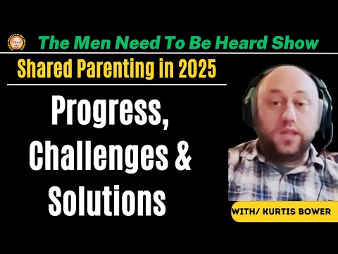
JACK POSOBIEC: ‘They’re trying to kill President Trump and they’re not going to stop’
After Donald Trump was targeted by an alleged would-be assassin for the second time in just over two months on Sunday, Jack Posobiec theorized that the deep state would not stop trying to kill the GOP presidential nominee during Monday’s episode of Human Events Daily.
Posobiec explained that the largest question yet to be answered surrounding the suspect, Ryan Routh, is about his direct ties with Ukrainian operations. Routh wrote books about Ukraine and was “directly tied with foreign fighter groups” going to the war-torn country as well as financial aid going to the Azov battalion.
Routh had been previously profiled by major mainstream media outlets including the New York Times over his ongoing attempts to bring foreign fighters from Kabul to Kyiv.
“There’s no question in my mind that he has overlapped with the national security agencies, and I can exclusively report from my sources that he did receive battlefield training in Ukraine,” Posobiec said, adding that the backpacks the potential shooter had with him contained ceramic tiles which could be used as “makeshift body armor.”
Routh had set these backpacks up against a fence to form a sniper’s nest hidden in the bushes surrounding Trump’s golf course in West Palm Beach where he reportedly hid for almost 12 hours before being spotted by secret security who shot at him. He fled and was later apprehended.
“Is it possible that these tactics were learned on the battlefield in Ukraine or from Ukrainian forces?” Posobiec pondered. “Was this a blowback? And the other question, by the way, how did he get a rifle if this guy was a former felon who wasn’t supposed to have a firearm with the serial number shaved off? Folks, you better get your head in the game. They are trying to kill President Trump, and they’re not going to stop.”
Watch the full episode below.
This Story originally came from humanevents.com
Stay Updated with news.freeptomaineradio.com’s Daily Newsletter
Stay informed! Subscribe to our daily newsletter to receive updates on our latest blog posts directly in your inbox. Don’t let important information get buried by big tech.
Current subscribers:
“Throw Society Into Chaos” – Tucker Outlines Dem Plan As Harris ‘Honeymoon’ Fades
Tucker Carlson said the quiet part out loud in a brief comment last last week. Uncomfortable truths about the “party of democracy”…
“If they think that there’s a chance that Trump could win decisively enough in November that they can’t steal it, then I think their only option there is to in some way throw the society into chaos as they did during COVID which was the pretext for changing the way we vote and letting people vote anonymously without IDs and drop boxes and a month before the election.”
We all know what happened then (and we, the people, acquiesced so quickly):
“They completely changed everything allowing Mark Zuckerberg to spend $400 million to control the mechanics of the election. That would not have been allowed except under a state of national emergency provided them by the virus they created in a lab in Wuhan, COVID.”
So, given what they have shown themselves capable of, who can really argue they would not do it (or worse) again:
“It’s pretty simple. If they feel like they’re gonna lose we will have some kind of crisis. I think it’s most likely to be a war with Iran which they want anyway, but who knows.”
Watch the full comment by Tucker Carlson below:
Tucker Carlson: “If they think that there’s a chance that Trump could win decisively enough in November that they can’t steal it, then I think their only option there is to in some way throw the society into chaos as they did during COVID which was the pretext for changing the… pic.twitter.com/e3mAkQPo8T
— Camus (@newstart_2024) September 14, 2024
Loading…
Originally Posted at; https://www.zerohedge.com//
Stay Updated with news.freeptomaineradio.com’s Daily Newsletter
Stay informed! Subscribe to our daily newsletter to receive updates on our latest blog posts directly in your inbox. Don’t let important information get buried by big tech.
Current subscribers:
Tropical Depression Gordon Public Advisory
000 WTNT32 KNHC 162140 TCPAT2 BULLETIN Tropical Depression Gordon Advisory Number 22 NWS National Hurricane Center Miami FL AL072024 500 PM AST Mon Sep 16 2024 ...GORDON STILL NOT WELL ORGANIZED... SUMMARY OF 500 PM AST...2100 UTC...INFORMATION ---------------------------------------------- LOCATION...19.0N 48.5W ABOUT 955 MI...1540 KM E OF THE NORTHERN LEEWARD ISLANDS MAXIMUM SUSTAINED WINDS...35 MPH...55 KM/H PRESENT MOVEMENT...W OR 270 DEGREES AT 6 MPH...9 KM/H MINIMUM CENTRAL PRESSURE...1006 MB...29.71 INCHES WATCHES AND WARNINGS -------------------- There are no coastal watches or warnings in effect. DISCUSSION AND OUTLOOK ---------------------- At 500 PM AST (2100 UTC), the center of Tropical Depression Gordon was located near latitude 19.0 North, longitude 48.5 West. The depression is moving toward the west near 6 mph (9 km/h). A turn toward the northwest and north is expected during the next day or so, followed by a turn toward the north-northeast on Wednesday. Maximum sustained winds remain near 35 mph (55 km/h) with higher gusts. Little change in strength is forecast during the next 48 hours. The estimated minimum central pressure is 1006 mb (29.71 inches). HAZARDS AFFECTING LAND ---------------------- None. NEXT ADVISORY ------------- Next complete advisory at 1100 PM AST. $$ Forecaster Pasch
Originally Posted at:
NATIONAL HURRICANE CENTER and CENTRAL PACIFIC HURRICANE CENTER
At The NATIONAL OCEANIC AND ATMOSPHERIC ADMINISTRATION
Stay Updated with news.freeptomaineradio.com’s Daily Newsletter
Stay informed! Subscribe to our daily newsletter to receive updates on our latest blog posts directly in your inbox. Don’t let important information get buried by big tech.
Current subscribers:
Does Kamala Harris want to decriminalize fentanyl and other drugs – and release people convicted of possessing them?
by Alex Berenson, Unreported Truths:
She did in 2019. In the wake of the titanic failure of Oregon’s experiment with drug decriminalization, has she changed her views? And will anyone ask her?
The question to Kamala Harris at a 2019 Texas conference couldn’t have been clearer:
“Would you broadly use your pardon power as president to release federal prisoners who are in prison merely for drug possession and drug-related crimes?” [emphasis added]
TRUTH LIVES on at https://sgtreport.tv/
Harris, four months into her failed 2020 presidential run, responded just as clearly:
“Absolutely, and we have to have the courage to recognize there are a lot of folks who have been incarcerated who should not have been incarcerated.”
These days, Harris isn’t so courageous when it comes to drug policy.
These days, she goes out of her way to obscure her views.
The “issues” page on her 2024 campaign Website says nothing about her oft-repeated view cannabis should be federally legalized – much less more controversial questions, like whether she favors decriminalizing the use of drugs like fentanyl and cocaine.
But from 2017 through 2019, as Harris was trying to gain Democratic support for her presidential run, she was not so cautious. She repeatedly said the United States needed to pivot to treating drug use as a public health crisis, not an issue for the criminal justice system – words drug policy “reformers” understand as code for decriminalizing possession and use.
In 2019, Harris let the mask slip all the way. In response to a question from the American Civil Liberties Union asking, “will you support the decriminalization at the federal level of all [emphasis added] drug possession for personal use?” —
Harris answered yes.
Decriminalization is not the same as full legalization, which allows the open production, trafficking, marketing and sale of drugs. Still, decriminalization lets users possess drugs for personal consumption and thus means that they cannot be arrested in most cases.
—
Like the question about pardons Harris faced at the “She The People” conference on April 24, 2019, in Houston, the ACLU’s question clearly included drugs other than cannabis, and Harris didn’t answer it that way.
Further, in a 15-page position paper on criminal justice she released for her 2019 campaign – a paper that contains the details so lacking from her “issues” Website today – Harris wrote, “it is past time to end the failed war on drugs, and it begins with legalizing marijuana.” [emphasis in original]
She added she supported “rehabilitation over incarceration for drug-related offenses.”
In other words, Harris saw cannabis legalization as only the first step in broader efforts to reduce penalties on drugs.
—
(You tell ‘em! But not now, don’t tell ‘em now! Things have changed.)
—
It is fair to say that Harris’s views aren’t as popular now as they were five years ago.
The crime spike that followed the Black Lives Matter-led effort to defund the police led many Americans to rethink the left’s softer approach to criminal justice. So did the breakdown in public order in the downtowns of many cities – particularly on the West Coast.
Meanwhile, “harm reduction” policies like increasing access to the overdose reduction drug naloxone and spending on addiction treatment have made no visible dent in the fentanyl/opioid crisis. In fact, deaths are higher under the Biden administration than Donald Trump’s presidency.
But the biggest and most visible failure of drug decriminalization since 2019 came in Oregon. That state abandoned a first-in-the-nation decriminalization effort this March, only three years after it began, because of soaring overdose deaths and crime.
Read More @ alexberenson.substack.com
Originally Posted at https://www.sgtreport.com
Stay Updated with news.freeptomaineradio.com’s Daily Newsletter
Stay informed! Subscribe to our daily newsletter to receive updates on our latest blog posts directly in your inbox. Don’t let important information get buried by big tech.
Current subscribers:
POTENTIAL TROPICAL CYCLONE EIGHT
Coastal Watches/Warnings and Forecast Cone for Storm Center
* If the storm is forecast to dissipate within 3 days, the “Full Forecast” and “3 day” graphic will be identical
Click Here for a 5-day Cone Printer Friendly Graphic
How to use the cone graphic (video):
About this product:
This graphic shows an approximate representation of coastal areas under a hurricane warning (red), hurricane watch (pink),
tropical storm warning (blue) and tropical storm watch (yellow). The orange circle indicates the current position of the
center of the tropical cyclone. The black line, when selected, and dots show the National Hurricane Center (NHC) forecast track of the center
at the times indicated. The dot indicating the forecast center location will be black if the cyclone is forecast to be
tropical and will be white with a black outline if the cyclone is forecast to be extratropical. If only an L is displayed,
then the system is forecast to be a remnant low. The letter inside the dot indicates the NHC’s forecast intensity for that time:
D: Tropical Depression – wind speed less than 39 MPH
S: Tropical Storm – wind speed between 39 MPH and 73 MPH
H: Hurricane – wind speed between 74 MPH and 110 MPH
M: Major Hurricane – wind speed greater than 110 MPH
NHC tropical cyclone forecast tracks can be in error. This forecast
uncertainty is conveyed by the track forecast “cone”, the solid white
and stippled white areas in the graphic. The solid white area depicts
the track forecast uncertainty for days 1-3 of the forecast, while the
stippled area depicts the uncertainty on days 4-5. Historical data
indicate that the entire 5-day path of the center of the tropical
cyclone will remain within the cone about 60-70% of the time. To
form the cone, a set of imaginary circles are placed along the
forecast track at the 12, 24, 36, 48, 72, 96, and 120 h positions,
where the size of each circle is set so that it encloses 67% of the
previous five years official forecast errors. The cone is then formed
by smoothly connecting the area swept out by the set of circles.
It is also important to realize that a tropical cyclone is not a point. Their
effects can span many hundreds of miles from the center. The area
experiencing hurricane force (one-minute average wind speeds of at least
74 mph) and tropical storm force (one-minute average wind speeds of
39-73 mph) winds can extend well beyond the white areas shown enclosing
the most likely track area of the center. The distribution of hurricane
and tropical storm force winds in this tropical cyclone can be seen in
the Wind History graphic linked above.
Considering the combined forecast uncertainties in track, intensity, and size, the
chances that any particular location will experience winds of 34 kt (tropical storm force),
50 kt, or 64 kt (hurricane force) from this tropical cyclone are presented in
tabular form for selected locations and forecast positions. This information is also presented in
graphical form for the 34 kt, 50 kt,
and 64 kt thresholds.
Note: A detailed definition of the NHC track forecast cone is also available.
Originally Posted at:
NATIONAL HURRICANE CENTER and CENTRAL PACIFIC HURRICANE CENTER
At The NATIONAL OCEANIC AND ATMOSPHERIC ADMINISTRATION
Stay Updated with news.freeptomaineradio.com’s Daily Newsletter
Stay informed! Subscribe to our daily newsletter to receive updates on our latest blog posts directly in your inbox. Don’t let important information get buried by big tech.
Current subscribers:
Trump to Speak in X Space Evening After Surviving Second Assassination Attempt
Former President Donald Trump announced that he will speak in X Space on Monday at 8:00 p.m. Eastern.
“Join me live from Mar-A-Lago at 8:00PM Eastern, tonight on X Spaces. Set a reminder and be sure to tune in!” Trump announced in an X post on Monday, sharing the link that will take social media users to the X Space so that they can listen live.
So far, President Trump has spoken in only one X Space, where he was joined by tech mogul Elon Musk for a live, unscripted interview on August 12.
It remains unclear if the 45th president will be hosting the X Space by himself on Monday evening or if he will be joined by others who will also be speaking in the live chat.
Notably, Trump’s announcement that he is doing another X Space comes one day after he survived a second assassination attempt against on his life.
On Sunday, wannabe assassin suspect Ryan Wesley Routh hid in the bushes near Trump International Golf Course, where he appeared to be lying in wait for Trump, who was golfing, to come into his view.
Routh had with him a rifle with a scope, backpacks, and a Go-Pro, according to the Palm Beach County Sheriff’s office.
Secret Service agents, who apparently travel a hole or two ahead of Trump while he’s golfing to secure the area, encountered Routh before he was able to fire rounds at the 45th president.
An agent apparently shot at Routh, who then fled the scene in a vehicle. A witness was able to take photos of the getaway car and its tag, the sheriff’s office said. From there, law enforcement caught up to the suspect and took him into custody.
The FBI now says it is investigating an apparent second assassination attempt against Trump. Florida Gov. Ron DeSantis (R), meanwhile, announced that the state of Florida will conduct its own investigation into what happened separate from the federal investigation.
It’s worth noting that just five days before the second assassination attempt against Trump, Vice President Kamala Harris told millions of Americans on live television during Tuesday’s presidential debate that Trump “wants to be a dictator on day one” an has enacted “the worst attack on our democracy since the Civil War” — rhetoric that undoubtedly could rile up deranged viewers.
Notably, Routh issued an X post to President Joe Biden earlier this year, writing, “DEMOCRACY is on the ballot and we cannot lose. We cannot afford to fail. The world is counting on us to show the way.”
The vice president, who is also this year’s Democrat party nominee, has posted to social media the exact same phraseology as the alleged Trump assassin.
Harris issued a vague statement after the assassination attempt against Trump, writing, “I have been briefed on reports of gunshots fired near former President Trump and his property in Florida, and I am glad he is safe. Violence has no place in America.”
Harris, however, failed to unequivocally clarify for her supporters that Trump is not an aspiring “dictator” nor “a threat to democracy.” She also failed to urge her supporters to refrain from conducting additional assassination attempts.
As Breitbart News reported, September 15 is the second assassination attempt Trump has survived within the span of two months.
President Trump narrowly survived the July 13 assassination attempt and was shot in the ear after Crooks opened fire on him while he was delivering his remarks during a campaign rally in Butler, Pennsylvania.
That first assassination attempt resulted in the death of former fire chief Corey Comperatore. Two other rally goers, David Dutch and James Copenhaver, were severely injured.
Alana Mastrangelo is a reporter for Breitbart News. You can follow her on Facebook and X at @ARmastrangelo, and on Instagram.
Originally Posted At www.breitbart.com
Stay Updated with news.freeptomaineradio.com’s Daily Newsletter
Stay informed! Subscribe to our daily newsletter to receive updates on our latest blog posts directly in your inbox. Don’t let important information get buried by big tech.
Current subscribers:
Potential Tropical Cyclone Eight Forecast Discussion
866 WTNT43 KNHC 162037 TCDAT3 Potential Tropical Cyclone Eight Discussion Number 5 NWS National Hurricane Center Miami FL AL082024 500 PM EDT Mon Sep 16 2024 Scatterometer data earlier today showed a very elongated surface circulation with frontal features extending from the low, confirming the non-tropical structure of the system. In fact, current observations show a significant temperature and dewpoint gradient remains along the boundary. Based on radar data and surface observations, the poorly-defined low center is likely near the coast or just inland over northeastern South Carolina. Although it failed to develop a well-defined center and the necessary organization to become a tropical cyclone, the low has produced significant impacts today, with life-threatening flash flooding reported in portions of southeastern North Carolina and wind gusts in excess of 60 mph along the coast. Another band of heavy rainfall is currently moving onshore over the Cape Fear region, with heavy rains also spreading farther inland. Recent surface observations show the sustained winds have diminished below tropical storm force, and the initial intensity is lowered to 30 kt. The system is moving north-northwestward at about 6 kt. This motion will bring the system farther inland over the Carolinas tonight and Tuesday, where it is expected to quickly weaken and dissipate. Although the wind threat has subsided, heavy rainfall and flash flooding remain a serious concern for portions of the Carolinas. For more information on this system, see products issued by the Weather Prediction Center and your local National Weather Service office. Since the system is no longer producing sustained tropical-storm-force winds, the Tropical Storm Warnings for the Carolinas have been discontinued. Therefore, this will be the final NHC advisory on the system. Key Messages: 1. Additional considerable flash and urban flooding and minor river flooding is possible across southern North Carolina and northeast South Carolina through tonight. There is also a risk of isolated flash and urban flooding for the southern Mid-Atlantic region and southern Appalachians through Wednesday. 2. Gusty winds will continue along portions of the coasts of South Carolina and North Carolina into this evening. FORECAST POSITIONS AND MAX WINDS INIT 16/2100Z 33.9N 78.8W 30 KT 35 MPH...POTENTIAL TROP CYCLONE 12H 17/0600Z 34.4N 79.6W 25 KT 30 MPH...POST-TROP/EXTRATROP 24H 17/1800Z 34.9N 80.9W 20 KT 25 MPH...POST-TROP/EXTRATROP 36H 18/0600Z...DISSIPATED $$ Forecaster Reinhart
Originally Posted at:
NATIONAL HURRICANE CENTER and CENTRAL PACIFIC HURRICANE CENTER
At The NATIONAL OCEANIC AND ATMOSPHERIC ADMINISTRATION
Stay Updated with news.freeptomaineradio.com’s Daily Newsletter
Stay informed! Subscribe to our daily newsletter to receive updates on our latest blog posts directly in your inbox. Don’t let important information get buried by big tech.
Current subscribers:
Potential Tropical Cyclone Eight Wind Speed Probabilities
000 FONT13 KNHC 162036 PWSAT3 POTENTIAL TROPICAL CYCLONE EIGHT WIND SPEED PROBABILITIES NUMBER 5 NWS NATIONAL HURRICANE CENTER MIAMI FL AL082024 2100 UTC MON SEP 16 2024 AT 2100Z THE CENTER OF POTENTIAL TROPICAL CYCLONE EIGHT WAS LOCATED NEAR LATITUDE 33.9 NORTH...LONGITUDE 78.8 WEST WITH MAXIMUM SUSTAINED WINDS NEAR 30 KTS...35 MPH...55 KM/H. Z INDICATES COORDINATED UNIVERSAL TIME (GREENWICH) ATLANTIC STANDARD TIME (AST)...SUBTRACT 4 HOURS FROM Z TIME EASTERN DAYLIGHT TIME (EDT)...SUBTRACT 4 HOURS FROM Z TIME CENTRAL DAYLIGHT TIME (CDT)...SUBTRACT 5 HOURS FROM Z TIME WIND SPEED PROBABILITY TABLE FOR SPECIFIC LOCATIONS CHANCES OF SUSTAINED (1-MINUTE AVERAGE) WIND SPEEDS OF AT LEAST ...34 KT (39 MPH... 63 KM/H)... ...50 KT (58 MPH... 93 KM/H)... ...64 KT (74 MPH...119 KM/H)... FOR LOCATIONS AND TIME PERIODS DURING THE NEXT 5 DAYS PROBABILITIES FOR LOCATIONS ARE GIVEN AS OP(CP) WHERE OP IS THE PROBABILITY OF THE EVENT BEGINNING DURING AN INDIVIDUAL TIME PERIOD (ONSET PROBABILITY) (CP) IS THE PROBABILITY OF THE EVENT OCCURRING BETWEEN 18Z MON AND THE FORECAST HOUR (CUMULATIVE PROBABILITY) PROBABILITIES ARE GIVEN IN PERCENT X INDICATES PROBABILITIES LESS THAN 1 PERCENT PROBABILITIES FOR 34 KT AND 50 KT ARE SHOWN AT A GIVEN LOCATION WHEN THE 5-DAY CUMULATIVE PROBABILITY IS AT LEAST 3 PERCENT. PROBABILITIES FOR 34...50...64 KT SHOWN WHEN THE 5-DAY 64-KT CUMULATIVE PROBABILITY IS AT LEAST 1 PERCENT. - - - - WIND SPEED PROBABILITIES FOR SELECTED LOCATIONS - - - - FROM FROM FROM FROM FROM FROM FROM TIME 18Z MON 06Z TUE 18Z TUE 06Z WED 18Z WED 18Z THU 18Z FRI PERIODS TO TO TO TO TO TO TO 06Z TUE 18Z TUE 06Z WED 18Z WED 18Z THU 18Z FRI 18Z SAT FORECAST HOUR (12) (24) (36) (48) (72) (96) (120) - - - - - - - - - - - - - - - - - - - - - - - - - - - - - - - - - - LOCATION KT FAYETTEVILLE 34 7 X( 7) X( 7) X( 7) X( 7) X( 7) X( 7) CHARLOTTE NC 34 X 3( 3) X( 3) X( 3) X( 3) X( 3) X( 3) SURF CITY NC 34 99 X(99) X(99) X(99) X(99) X(99) X(99) WILMINGTON NC 34 99 X(99) X(99) X(99) X(99) X(99) X(99) BALD HEAD ISL 34 37 X(37) X(37) X(37) X(37) X(37) X(37) FLORENCE SC 34 1 2( 3) X( 3) X( 3) X( 3) X( 3) X( 3) LITTLE RIVER 34 8 X( 8) X( 8) X( 8) X( 8) X( 8) X( 8) MYRTLE BEACH 34 6 X( 6) X( 6) X( 6) X( 6) X( 6) X( 6) $$ FORECASTER REINHART
Originally Posted at:
NATIONAL HURRICANE CENTER and CENTRAL PACIFIC HURRICANE CENTER
At The NATIONAL OCEANIC AND ATMOSPHERIC ADMINISTRATION
Stay Updated with news.freeptomaineradio.com’s Daily Newsletter
Stay informed! Subscribe to our daily newsletter to receive updates on our latest blog posts directly in your inbox. Don’t let important information get buried by big tech.
Current subscribers:
Potential Tropical Cyclone Eight Forecast Advisory
000 WTNT23 KNHC 162036 TCMAT3 POTENTIAL TROPICAL CYCLONE EIGHT FORECAST/ADVISORY NUMBER 5 NWS NATIONAL HURRICANE CENTER MIAMI FL AL082024 2100 UTC MON SEP 16 2024 POTENTIAL TROP CYCLONE CENTER LOCATED NEAR 33.9N 78.8W AT 16/2100Z POSITION ACCURATE WITHIN 40 NM PRESENT MOVEMENT TOWARD THE NORTH-NORTHWEST OR 335 DEGREES AT 6 KT ESTIMATED MINIMUM CENTRAL PRESSURE 1006 MB MAX SUSTAINED WINDS 30 KT WITH GUSTS TO 40 KT. 12 FT SEAS..350NE 120SE 120SW 45NW. WINDS AND SEAS VARY GREATLY IN EACH QUADRANT. RADII IN NAUTICAL MILES ARE THE LARGEST RADII EXPECTED ANYWHERE IN THAT QUADRANT. REPEAT...CENTER LOCATED NEAR 33.9N 78.8W AT 16/2100Z AT 16/1800Z CENTER WAS LOCATED NEAR 33.4N 78.5W FORECAST VALID 17/0600Z 34.4N 79.6W...POST-TROP/EXTRATROP MAX WIND 25 KT...GUSTS 35 KT. FORECAST VALID 17/1800Z 34.9N 80.9W...POST-TROP/EXTRATROP MAX WIND 20 KT...GUSTS 30 KT. FORECAST VALID 18/0600Z...DISSIPATED REQUEST FOR 3 HOURLY SHIP REPORTS WITHIN 300 MILES OF 33.9N 78.8W THIS IS THE LAST FORECAST/ADVISORY ISSUED BY THE NATIONAL HURRICANE CENTER ON THIS SYSTEM. FOR MORE INFORMATION...SEE PRODUCTS ISSUED BY YOUR LOCAL NATIONAL WEATHER SERVICE FORECAST OFFICE. $$ FORECASTER REINHART
Originally Posted at:
NATIONAL HURRICANE CENTER and CENTRAL PACIFIC HURRICANE CENTER
At The NATIONAL OCEANIC AND ATMOSPHERIC ADMINISTRATION
Stay Updated with news.freeptomaineradio.com’s Daily Newsletter
Stay informed! Subscribe to our daily newsletter to receive updates on our latest blog posts directly in your inbox. Don’t let important information get buried by big tech.
Current subscribers:
Potential Tropical Cyclone Eight Public Advisory
000 WTNT33 KNHC 162036 TCPAT3 BULLETIN Potential Tropical Cyclone Eight Advisory Number 5 NWS National Hurricane Center Miami FL AL082024 500 PM EDT Mon Sep 16 2024 ...LIFE-THREATENING FLASH FLOODING AND GUSTY WINDS CONTINUE ACROSS PORTIONS OF SOUTHEASTERN NORTH CAROLINA... ...REFER TO LOCAL NATIONAL WEATHER SERVICE OFFICE PRODUCTS FOR FUTURE INFORMATION ON THIS SYSTEM... SUMMARY OF 500 PM EDT...2100 UTC...INFORMATION ---------------------------------------------- LOCATION...33.9N 78.8W ABOUT 45 MI...75 KM W OF CAPE FEAR NORTH CAROLINA ABOUT 100 MI...160 KM NE OF CHARLESTON SOUTH CAROLINA MAXIMUM SUSTAINED WINDS...35 MPH...55 KM/H PRESENT MOVEMENT...NNW OR 335 DEGREES AT 7 MPH...11 KM/H MINIMUM CENTRAL PRESSURE...1006 MB...29.71 INCHES WATCHES AND WARNINGS -------------------- CHANGES WITH THIS ADVISORY: All Tropical Storm Warnings have been discontinued. SUMMARY OF WATCHES AND WARNINGS IN EFFECT: There are no coastal watches or warnings in effect. DISCUSSION AND OUTLOOK ---------------------- At 500 PM EDT (2100 UTC), the disturbance was centered near latitude 33.9 North, longitude 78.8 West. The system is moving toward the north-northwest near 7 mph (11 km/h). A northwestward motion is expected during the next day or so, and the low will move inland across the Carolinas tonight and Tuesday. Surface observations indicate that maximum sustained winds have decreased to near 35 mph (55 km/h) with higher gusts. Continued weakening is expected during the next day or so, and the low is forecast to dissipate over the Carolinas by early Wednesday. * Formation chance through 48 hours...low...near 0 percent. * Formation chance through 7 days...low...near 0 percent. The estimated minimum central pressure based on surface observations is 1006 mb (29.71 inches). HAZARDS AFFECTING LAND ---------------------- Key messages for Potential Tropical Cyclone Eight can be found in the Tropical Cyclone Discussion under AWIPS header MIATCDAT3 and WMO header WTNT43 KNHC. WIND: Gusty winds are expected to diminish this evening along the coast of North Carolina. STORM SURGE: Water levels remain elevated along portions of the southeastern North Carolina coast and will begin to subside after the next high tide cycle. Refer to your local National Weather Service office for additional information. RAINFALL: The system will bring an additional 4 to 8 inches of rainfall, with isolated totals of 10 inches, across portions of southeast North Carolina into tonight. Across northern South Carolina and the remainder of North Carolina, 2 to 4 inches of rainfall, with isolated totals near 8 inches, particularly in the North Carolina Blue Ridge, are possible through Tuesday. Over southeast Virginia and the Virginia Blue Ridge, expect 2 to 4 inches of rainfall, with locally higher amounts, tonight through Wednesday. This rainfall brings a risk of flash and urban flooding and minor river flooding. For a complete depiction of forecast rainfall associated with this system, please see the National Weather Service Storm Total Rainfall Graphic, available at hurricanes.gov/graphics_at3.shtml?rainqpf and the Flash Flood Risk graphic at hurricanes.gov/graphics_at3.shtml?ero. TORNADOES: A few tornadoes may occur through this evening across eastern North Carolina. SURF: Swells are forecast to affect portions of the coast of the southeastern United States through tonight. These swells are likely to cause life-threatening surf and rip current conditions. Please consult products from your local weather office. NEXT ADVISORY ------------- This is the last public advisory issued by the National Hurricane Center on this system. For more information, see products from your local National Weather Service forecast office. $$ Forecaster Reinhart
Originally Posted at:
NATIONAL HURRICANE CENTER and CENTRAL PACIFIC HURRICANE CENTER
At The NATIONAL OCEANIC AND ATMOSPHERIC ADMINISTRATION
Stay Updated with news.freeptomaineradio.com’s Daily Newsletter
Stay informed! Subscribe to our daily newsletter to receive updates on our latest blog posts directly in your inbox. Don’t let important information get buried by big tech.
Current subscribers: